Enjoying Outside, Inside - Online Maps and Mapping Tools

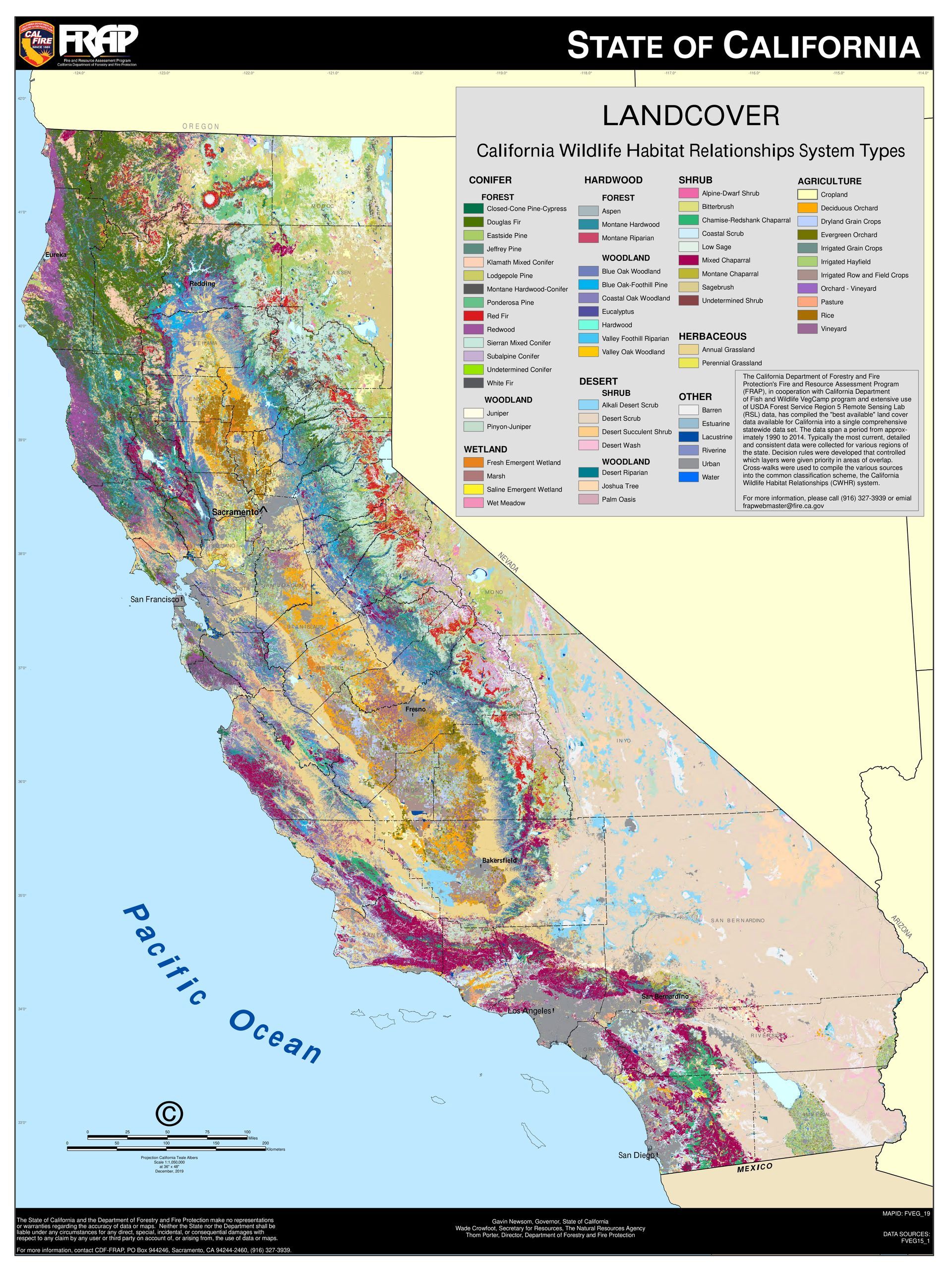
Vegetation cover in California (CalFire)
Sometimes maps are the next best thing to being actually outside. They let us imagine journeys, prepare for disaster, and make unexpected connections. There are an unbelievable number of maps online that allow us to explore our world. Here are just a few maps and mapping tools to dive into.
For hikers there are a couple of highly interactive resource that allow you to build your own maps:
- Caltopo lets you build, save, and print amazingly detailed maps. Hit the "Start mapping" button to build your map. First zoom in on the area you want, then select your base map, and then choose overlays, which can give you everything from a fairly crude geology map to cell phone coverage to a wind plot for a time of your choosing up to 36 hours in the future.
- Topobuilder at USGS helps you to build your own custom 7.5 minute topo map. If Ithere a place you want to hike that runs over two topo maps, this pilot program allows you to select an area that is the same size as the classic 7.5 minute topo map and build a map that has just as much detail. Be aware that you may need some ingenuity to print your map at a workable resolution. They have a detailed user guide too.
To explore California on a large scale, try the maps at CalFire's Fire Resource Protection Program. They have numerous high-resolution pdf maps that immediately stimulate questions and thought. They also have GIS data for pro mappers. Here are a few highlights:
The ownership map shows public lands in California and makes it easy to locate parks.
The vegetation cover map shows wildlife habitat types throughout the state.
The fire perimeters map shows areas for large wildfires from 1950 to 2021.(This one is download-only; click on Fire Perimeters.)
Speaking of fire, Inciweb shows wildland fires across the nation, including prescribed burns. Zoom in to see active California fires. Clicking on incidents gets you to the most recent public updates and perimeter maps. Airnow.gov has a specialized fire and smoke map that shows especially active plumes and where air quality is good or poor.
You can also see the latest earthquakes in the US or around the world at the USGS: how big, how recent, and how close to populated areas.
Check out this previous Enjoying Outside, Inside article for more maps!
-Amy Boyer
RECENT ARTICLES


