


News & Insights
All Blog Posts

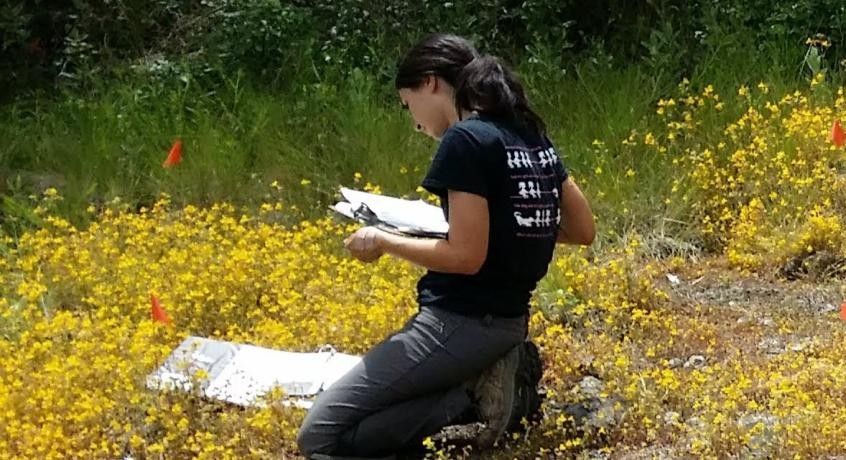
From left to right, Horticulture Interns Ellen Jenkins, Rithika Warrier, and Diego Barraza Hernandez, with Education Associate Geoff Benn, who coordinates the internship program. From September to June, I worked as a Horticultural Intern at Tuleyome. Each week at the Woodland Regional Park Preserve, I would meet with my mentor Teri Barry. Over the course of the year, we worked together identifying, documenting, and analyzing the preserve's growth. Through this opportunity, I gained experience in hands-on restoration efforts, familiarity with plant taxonomy and classification, and community outreach.

I’m sure you already know that the Bald Eagle is used as a symbol of our Nation’s freedom, strength, perseverance and independence. It is said that our founding fathers chose the Bald Eagle to adorn our Great Seal because it is indigenous to North America and if you look closely at it, you’ll see that it is holding 13 arrows and an olive branch simultaneously symbolizing the power of war and the power of peace. But, what about our national mammal? Er, maybe you didn’t even realize that we had a national mammal… President Barack Obama designated the American Bison as our national mammal in May of 2016. It too is endemic to North America and in prehistoric times, millions of them roamed through roughly two-thirds of the United States. Their range was known as the “great bison belt” - a stretch of habitat that encompassed the forests of Alaska, the grasslands of the North American plains and stretched from the Great Basin east to the eastern Appalachian Mountains. Side note - I’m just gonna come clean right now and tell you that the historic range of the American bison, American Buffalo or just plain bison or buffalo does NOT include the Berryessa Snow Mountain National Monument (Monument). I’m supposed to be writing about the Monument region and I picked a topic that is clearly not there but it’s important and they are impressive so please don’t tattle. Another side note - the American Bison and the American Buffalo are one in the same and both names can be used interchangeably. Its scientific name (genus and species) is actually Bison bison so I guess calling them bison is probably more scientifically accurate but either works. Bison are North America’s largest land animal; an adult male averages about 2,000 pounds - that’s a ton (thanks Schoolhouse Rock, I will never forget this one!), are about 12 feet long from nose to rump and about six feet tall. Females max out at around 1,000 pounds and are a little over nine feet long. In the wild bison can live ten to twenty years. Both females and males have massive forequarters and sport what looks like a shaggy, long-sleeved sweater. Both sexes have short, curved horns that are an integral part of their status in the herd and defensive strategy. During the snowy winters, bison display a dark brown winter coat and in the summer they show off their lighter brown summer-bods. Calves typically arrive from March through May depending on weather conditions. When they’re first born calves are an orangey-red color which earned them the nickname “red dogs”. Within a few months they become darker brown like their parents and their little horns start to poke through. Around this time they also begin to develop their iconic shoulder hump. The hump is made of solid muscle buttressed by elongated vertebrae. This dense network of muscles act as a powerhouse that allows the animal to swing its massive head from side to side and plow through icy snow to access buried forage enabling them to survive even the harshest winters. Although they are not known for keen eyesight, bison have superb senses of hearing and smell. As monumental (get it?) as these animals are, they are shockingly quick and agile. Bison have been clocked at running 35 miles per hour (!), they can spin and turn on a dime, leap over high fences and are incredibly adept swimmers. All these mad skills on a strictly vegetarian diet - that’s ruminant efficiency. For thousands of years, before the European settlers arrived, Native Americans of all tribes and regions revered the bison. They were the cultural, spiritual and resource backbone of indigenous societies across the United States. Every part of the animal was used; the meat was consumed, the hide was used for clothing, shoes and shelters, and the bones and hooves were used for tools and weapons. Even the sinew was used for sewing and bow strings. Everything was copacetic then came the Europeans with their domestic cattle diseases and thoughtless greed. Bison were hunted to near extinction within roughly just 100 years. Their numbers went from an estimated 60 million (!) to less than 550 individual animals by 1889. They were hunted mercilessly and their habitat destroyed, some say as a way to control the Native Americans by removing their primary resource. One of the buffalo’s biggest fans was President Teddy Roosevelt. In the early 1880’s he traveled to what is now North Dakota (shout out to my people!) to hunt. After recognizing the bison’s diminishing population numbers he co-founded the American Bison Society in 1905 to help conserve and protect this American emblem. For many years the few buffalo that remained were only found in national parks and preserves but primarily on Native American reservations. Had it not been for the willingness of tribes across the country to work with interested individuals and state and federal governments, the American Bison would be gone today. Much like the Bald Eagle, the bison is an authentic symbol of American character and as it turns out, another one of the greatest conservation success stories in U.S. history. The bison within the Yellowstone National Park boundaries are direct descendants of the original animals that roamed our country’s grasslands and are the only herd that still occupy their original prehistoric location. This free-ranging herd numbers approximately 5,500 animals and is the largest herd on public land. Recovery efforts paid off and today bison can be found in all 50 states including private and tribal lands, national parks and wildlife refuges.

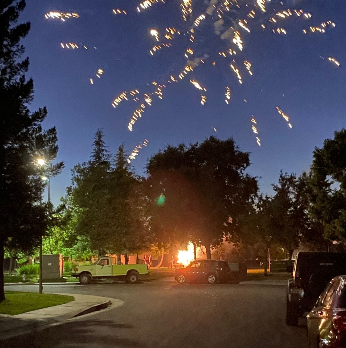
Every year over 10,000 people in the United States are injured by fireworks with children and young adults accounting for half of that number. Face and eye injuries and burns to the hands and arms are the most commonly treated firework injuries in the Emergency Room. Even innocuous seeming sparklers burn at around 2,000 degrees, hot enough to melt some metals. On top of the risk of injury, steep price tags are an insult to injury (pun intended). Even more serious than the cost though is the fire danger fireworks pose to our wildlands and property. The National Safety Council states that fireworks are the cause of about 30,000 fires, including structure, vehicle and other fires causing millions of dollars in property damage nationally each year. In addition, the lighting and performance of fireworks not only contributes to air pollution but particulate matter can affect breathing for those with respiratory sensitivity. The chemicals used to make fireworks eventually fall to the ground and can pollute water and soil and be detrimental to humans, wildlife and the environment. Another noxious side effect of fireworks is the outcome they may have on those suffering from Post Traumatic Stress Disorder. Neurodivergent people or those with sensory processing disorders may also have a difficult time with the flashing lights, loud booms or high pitched whistles made by fireworks. The sight and sound of fireworks also confuses and terrifies pets and wildlife causing trauma and injuries. They become disoriented and may run into roadways; some wildlife may even abandon their young. Heard enough? Keep reading for some safer, family friendly alternatives to fireworks. Glow sticks are a fun and safe family friendly option to 2,000 degree sparklers. You can usually find them in the dollar section at Target or at the Dollar Store for much less than anything you will find at a firework stand and they last all night and will probably still be glowing strong the next day. They’re a fun addition to a game of night tag to burn off the sugar from your post bbq smores. Another fun activity for the littles and the not so littles is good old fashioned bubbles. Actually I think they’re a perfect activity for any age, any time of year but for some reason having a bubble blowing contest seems synonymous with the 4th of July. My dogs also love to chase the bubbles so they can get involved in the fun too. You can even make your own bubbles and color the solution with red, white and blue if you’d like. Super fun fact - did you know you can make bubbles that glow in the dark with a black light?! Here are the ingredients and instructions on how to make that happen! Confetti filled poppers are a fun way to celebrate and still make a little noise. You can buy them prepacked or you can add to the fun by easily making your own. Here are the instructions to make your own poppers. You can even fill them with popped popcorn, dried flower petals or birdseed so you don’t have to sweep up - as long as you do it outside! You can also use a can or six of Silly String to celebrate America. Spray it with reckless abandon (but be sure to check with your mom first). Drone shows are dazzling and absolutely mind bending to watch. The City of Rancho Cordova has a drone show scheduled for both July 3rd and 4th. Information can be found here . The City of Elk Grove also has a drone show at Elk Grove Regional Park on July 4th. Details can be found here . If it’s just not the same without the smell of sulfur, nearby cities such as Rancho Cordova, Elk Grove, Davis, Dixon and Woodland all host professional firework displays that you can attend in person. Sutter Health Park (River Cats/A’s stadium) is also hosting post game fireworks that are viewable from nearby even if you don’t attend the game. And, if you do choose to do fireworks at your private celebrations, please be sure to make sure they are legal in your area and that you follow safety precautions such as having a bucket of water and a hose nearby, soak spent fireworks in water overnight and never try to relight something. Tuleyome wishes you all a happy and safe Revolution Day!
Our June Nature and You lecture was presented by Madeline Drake, Deputy Secretary for Biodiversity and Habitat at the California Natural Resources Agency. She gave an inspiring talk on the work being done in California to meet the 30x30 goal, which seeks to conserve 30% of the state’s lands and coastal waters by 2030. If you missed it, you can watch the recording here .
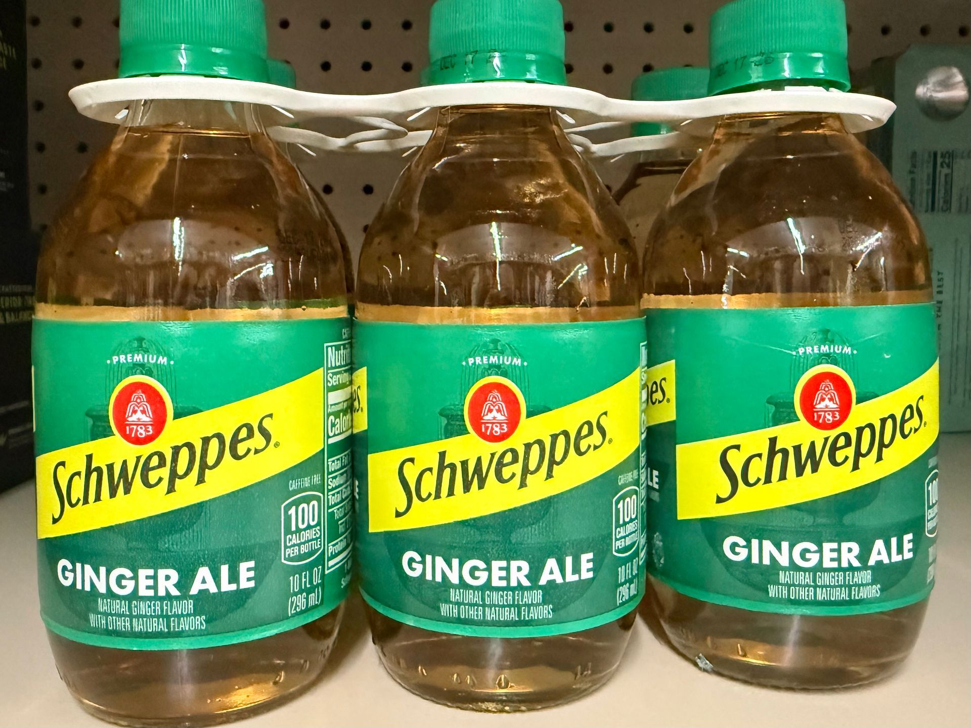
The late 18th century had some pretty significant contributions to world history. Of course one big one is the reason we celebrate July 4 and this year's celebration is a MONUMENTAL one. But if you dig a little deeper you’ll find many other epic scientific advancements to our modern lives that came about then too. Not to make light of any of the inventions of that time but you might want to dial back your dazzle meter just for a bit. To put these contributions into context, prior to 1776 the printing press was the social media of the time and the lightning rod was all the rage way before the lightning cable. The Franklin stove - the must-have high-tech major appliance of the time. It was the first of its kind and hecka trendy. It was a metal lined stove that allowed families to not only efficiently heat their house during the brutal New England winters but it also allowed them to cook food, indoors, over an open flame without dealing with the particulate matter and volatile organic compounds that we have all become so well versed in. Franklin never patented his stove which allowed others to use his design and improve on it. Other hot trends of the late 18th century include indoor plumbing. Flush toilets to be precise. Although the idea was first introduced in 1596 it never really went down (get it?!) as an interior decorating sensation. Advances made during the industrial revolution allowed toilet improvements such as the S-trap which is still used in our toilets today. Technological advances including the flapper and float were added later and patented in 1778. This original design was used for about another 100 years. Early in the First Industrial Revolution Scottish chemist, mechanical engineer and inventor James Watt revolutionized the existing commercial steam engine previously introduced in 1712. Think of it as going from the old-timey wall-mounted crank phone to the smart phone in your pocket. Watt’s engine design incorporated new concepts such as a separate condenser and continuous rotary motion. During his life Watt secured six primary patents. The watt - the unit of measurement of electrical and mechanical power, is named in his honor. The very first submarine attack also happened in 1776 because of another new innovation - The Turtle. Impressive name, right? Super intimidating. The Turtle was a one man, pedal powered oak barrel sealed with tar and held together with iron hoops. It was shaped like a turtle shell and the driver operated the propellers with hand cranks and foot pedals. If you weren’t in Tour de France shape when you went down, you would be when you resubmerged. The Turtle was the first submersible to use a ballast system to lower and raise the vessel. The pilot relied on breathing tubes from the surface and only had 30 minutes of air in the vessel once fully submerged. In September 1776 U.S. Army Sergeant Ezra Lee volunteered to take the Turtle on her maiden voyage to attack the British HMS Eagle in New York Harbor. The goal was to attach explosives to the hull of the ship but the hand-powered drill couldn’t penetrate the ship's copper-lined hull and the mission was aborted. Although the Turtle never sank any enemy war ships it did revolutionize Naval warfare. In other water related affairs, the marine chronometer was patented just before the turn of the calendar in December 1775. The chronometer, a portable clock that uses a special mechanism so accurate that longitude could be determined at sea, was originally invented in 1737 by John Harrison. Later, John Arnold made vast improvements to the chronometer and took out his first patent on December 30, 1775. A nautical mile is based on latitude and longitude. One nautical mile equals one minute of latitude, so timekeeping was imperative for precise navigation and ordinary pendulum clocks were worthless at sea due to changing temperatures and the ship’s motion. Chronometers are still used today but are much smaller and look similar to a stopwatch, some are small enough to be incorporated into a wrist watch. Artificially carbonated water was first concocted in 1767 by British chemist Joseph Priestly. Although Priestly had many contributions to science such as isolating oxygen in its gaseous state, he is best known for his development of soda water and has been credited with being the “father of the soda industry”. In 1772, he provided Captain James Cook’s crew with a pamphlet titled “Directions for Impregnating Water with Fixed Air” to help calm seasick tummies. It wasn’t until 1780 that a watch maker, J.J. Schweppe (yep, that guy) commercialized packaged effervescence and the rest is history. Side note - at one time soda water was thought to be the cure for scurvy. Identifying the actual cure, vitamin C, was also a 18th century revolution. So perhaps enjoy a cold Schweppes ginger ale or appreciate your indoor loo while celebrating our nation’s semiquincentennial birthday! Happy 4th of July!!
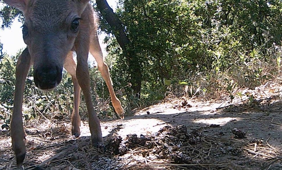
A black-tailed deer fawn investigates a game camera at Conaway Ranch. We’ve got new game camera footage from Conaway Ranch! This month, we captured footage of fawns, wood ducklings, river otters, and more – check out the video here . Tuleyome partners with Conaway Preservation Group to provide educational programs for youth and adults at Conaway Ranch. The game camera videos are used as part of pre-field trip activities for K-12 classes coming to the Ranch for Tuleyome programs. If you have any questions about the game cameras or out programs at Conaway Ranch, please contact Education Associate Geoff Benn at gbenn@tuleyome.org.
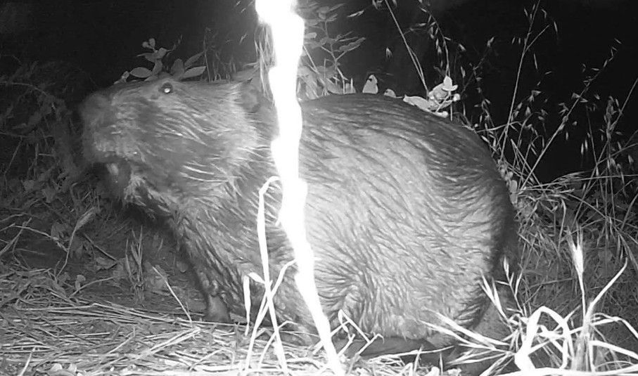
A beaver at Conaway Ranch We’ve got new footage from our game cameras at Conaway Ranch! This camera site was chosen by 4 th graders from Dingle Elementary during a recent field trip to Conaway. The camera is near the otter slide we’ve previously filmed, but is a few feet away from the entrance to the slide, allowing us to film the animals as they approach. We saw beaver, otter, a fox, a raccoon, and more! Click here to watch the video . Tuleyome works with Conaway Preservation Group to offer educational programs at Conaway Ranch, including programs for K-12 groups and the general public. If you have any questions about the game camera footage or our programs at Conaway, please reach out to Education Associate Geoff Benn at gbenn@tuleyome.org.
The current administration has released its proposed budget for the 2027 fiscal year. It proposes drastic cuts to our public land management agencies. The proposed budget would significantly reduce funding for the Bureau of Land Management (BLM), including a 34% cut to its total budget, a 27% staff cut, a 76% cut to the National Conservation Lands, which encompass 38 million acres of protected public lands, a 61% cut to recreation management (including campsites and trails), and total elimination of funding for cultural resources and wilderness management. It also would shift priorities towards extractive uses of public lands instead of conservation and clean energy. The administration’s budget would also drastically cut funding to the U.S. Forest Service (USFS), eliminate several offices, state and federal research stations (six in California) and transfer all fire fighting to BLM. Notably, in the face of all these cuts, the budget would increase funding for extractive industries; funding for timber sales would increase 450%. The reductions and policy changes would impair these agencies’ abilities to protect public lands, cultural resources, fresh water sources, and wildlife, while also impairing access to them and recreation on them. The President’s budget is now in Congress, where committees in both the Senate and the House of Representatives are amending and voting on the bills in preparation for full House and Senate votes. Now is the time to take action for our public lands and the environment by urging Congress to reject the proposed budget and maintain funding for BLM, USFS, and programs that protect and steward our public lands. Let your representatives know that you oppose the cuts to BLM and USFS and the rollbacks to our public land protections. And let them know why these special places are important to them. You can voice your opinions to Congress in multiple ways. You can: Call their offices Send a letter to Congress - we’ve pulled together a template for you to use, but don’t forget to let them know why public lands are important to you – download sample letter here Contact them on social media Meet with a representative in their District offices. Don’t know how to reach them, go to Congress.gov and find their phone numbers, addresses, district offices, websites and so much more if you’re interested. Now is the time to speak up for our public lands! Mary Lamborn (Communications Intern) and Sandra Schubert (Executive Director)