Monumental Questions - What's the Deal with the Bald Eagle?

Kristie Ehrhardt • January 9, 2025


Since 1782, the Bald Eagle (Haliaeetus leucocephalus) has been the national bird of the United States.


Except, it wasn’t…until now.


It wasn’t the official national bird of the United States until December 24, 2024 when President Biden signed a law officially honoring the Bald Eagle as our national bird. For nearly 250 years, pretty much everyone recognized it as a symbol of America’s strength, courage, freedom and immortality but very few people realized that it had never been made official by an act of Congress.


Since 1782, the bird has appeared on the Great Seal of the United States. It is on our currency and used on official documents of nearly every United States federal agency. One Bald Eagle named “Old Abe” even went into battle during the Civil War. He was the constant target of enemy riflemen but survived 42 battles relatively unscathed. Why they brought him along I don’t understand at all but his record is impressive and somewhat comparable to the Bald Eagle’s life history since Europeans arrived here.


Native Americans lived peacefully with the apex predator for thousands of years. But, for over 200 years, newly arrived settlers accused the Bald Eagle of stealing livestock and even kidnapping babies which resulted in an all out eagle execution. By the late 19th century, Bald Eagle sightings had become uncommon where they were once plentiful. The National Emblem Act of 1940 declared protection from deliberate harm for the birds only to have dichlorodiphenyltrichloroethane (DDT) become widely available in 1945. As a result, again the raptor’s population took a drastic nose dive landing it on the United States Fish and Wildlife Endangered Species List. By the early 1960’s, less than 500 breeding pairs of Bald Eagles remained in the entire United States, less than 30 pairs were left in California. In 1972, the United States Environmental Protection Agency banned the use of DDT which, over time, has finally resulted in a conservation success story. It was removed from the Endangered Species List on June 28, 2007. Today there are over 500,000 breeding pairs in North America, a population equal to when the Bald Eagle was originally put on the Great Seal.


What does this have to do with the Berryessa Snow Mountain National Monument?


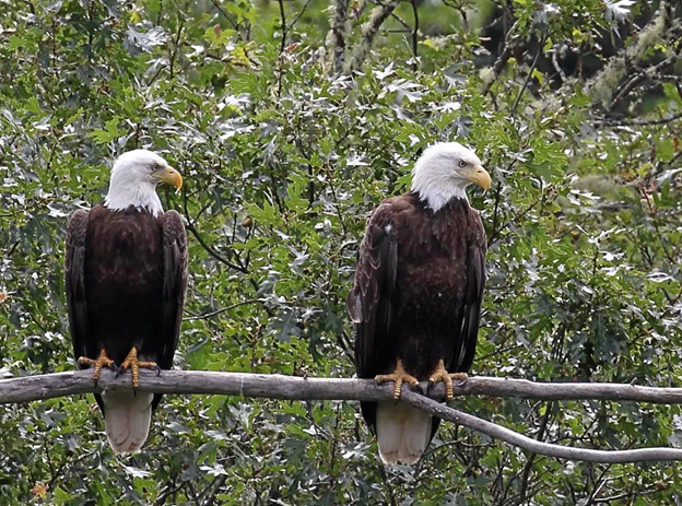
The Berryessa Snow Mountain National Monument hosts the second largest population of wintering Bald Eagles in California. The best time to see our population of wintering eagles is from December to March. While they are here, they can be found in many locations around the region including the Colusa and Sacramento National Wildlife Refuges, Cache Creek and Putah Creek, Capay Valley, Clear Lake and Lake Berryessa. It’s peak Bald Eagle viewing time and it just so happens that the San Francisco Chronicle recently named our favorite national monument one of the best places in California to visit in 2025 so head out to explore and don’t forget your binoculars!


-Kristie Ehrhardt (kehrhardt@tuleyome.org)

Tuleyome Land Conservation Program Manager

RECENT ARTICLES

By Nate Lillge August 6, 2025
Bill Grabert is stepping down from his position as treasurer on Tuleyome’s volunteer Board of Directors – we thank him for his many years of service! Bill first joined Tuleyome as a staff member in 2016. His nature-based teaching influenced many youth over the years with school field trips throughout the Berryessa Snow Mountain National Monument region, from Redbud Trail to Conaway Ranch. As part of Tuleyome’s team of instructors for the California Certified Naturalist program, Bill inspired adults to care for the region. His love of the area began as soon as he graduated from college and began working as a geologist in Lake County. Bill has devoted his diverse knowledge and skillset to care for, steward, and enjoy California’s northern Inner Coast Range Mountains for many years. He will be missed on the Board but we look forward to seeing him on the trails! -Nate Lillge (Adventures and Engagement Director)  and Lyndsay Dawkins (Volunteer Tuleyome Board President)
By Bryan Pride August 6, 2025
Fifty-eight and a half million acres of America's wildest forests have been protected for nearly 25 years by the Roadless Rule, a conservation cornerstone that could soon disappear. Established in 2001, the Roadless Area Conservation Rule (RACR) , more commonly known as the Roadless Rule, designated "Inventoried Roadless Areas" (IRAs) across our nation's forests, prohibiting new roads from being built. Now, USDA Secretary Rollins wants to rescind it . From Alaska to California, the losses from this rollback would be massive. In Alaska, 92% of the Tongass National Forest could lose protection, threatening one of the world's most pristine ecosystems and the indigenous communities who call it home. California would lose protections across 4.4 million acres spanning 21 national forests , which has the potential to impact treasured places like Inyo, Shasta-Trinity, and the Berryessa Snow Mountain National Monument. Rule Born from Necessity, Not Ideology The Roadless Rule traces back to 1998, when U.S. Forest Service Chief Mike Dombeck saw the agency's vast road system as a major environmental and fiscal problem . To put this in perspective: the Forest Service maintains eight times more miles of road than the Interstate Highway System. The agency had too many roads to properly maintain for safety and environmental purposes, with poorly maintained roads contributing to erosion and other harms across national forests. The road maintenance backlog had ballooned to $8.4 billion while the agency received only 20% of the funding needed to maintain roads to environmental and safety standards. Dombeck proposed a moratorium on road construction in undeveloped forest areas across most of the National Forest System. The agency adopted an 18-month moratorium in February 1999 pending completion of an overall road management plan. Later that year, the agency undertook a rule making process to provide long-term administrative protection for roadless areas. The Forest Service conducted an extensive public involvement process that produced 1.7 million comments , with the majority favoring a strong national policy protecting roadless areas. The resulting Roadless Rule was not and is still not a blanket ban: it makes exceptions to allow access to non-federal land inholdings and pre-existing mineral leases, and allows logging to reduce fire risk, improve habitat or aid in the recovery of endangered species. What began as a fiscally prudent solution to an unwieldy road network became a cornerstone of forest conservation, one that Americans overwhelmingly supported then and continue to support today. The Administration's Claims vs. Reality According to USDA Secretary Rollins , the rule is “overly restrictive”, hinders fire prevention and responsible timber production, therefore the Rule poses “real harm to millions of acres of our national forests.” Rollins linked rescinding the Rule with Presidential Executive Order 14192, "Unleashing Prosperity Through Deregulation .” The reality is different. Rollins' claim ignores what's actually at stake. Roadless areas are essential ecosystems that provide clean air and water while keeping wilderness intact. They also serve as critical refuges for wildlife; 57% of America's most vulnerable species depend on roadless areas for habitat. For the 156 million Americans who visit national forests annually, these areas offer irreplaceable backcountry recreation experiences. Most strikingly, the administration's fire prevention argument is backwards. Scientific research reveals that 88% of wildfires are human-caused , and 95% of these fires start within half a mile of a road. Areas closest to roads experience 53% more fires than would occur by random chance. Less than 3% of wildfires start in wilderness areas more than a mile from roads. This research indicates that more roads through our forests are more likely to increase fires and would outweigh the effects of improving fire containment. While the administration claims roads improve fire response, fire management teams consistently identify inadequate resources and personnel shortages, not roads , as the primary barriers to effective wildfire management . Rather than building roads that increase fire risk, fire management experts advocate for investing in cultural and prescribed burns, fire mitigation and forest restoration, proven approaches that are underfunded but key to preventing future fires and reducing fire magnitude. What's Next? Rescinding the Roadless Rule will require a public comment period that has yet to be announced. This is when we can all share our views. Tuleyome will be following this issue closely and will be commenting. For more information on the Roadless Rule and how to participate in the public comment process or other advocacy opportunities, contact B ryan Pr ide .
By Kristie Ehrhardt August 6, 2025
The short answer is honestly, pretty much anywhere! Because the 344,476 acre Berryessa Snow Mountain National Monument (the Monument) is located in the rural areas of Colusa, Glenn, Lake, Mendocino, Napa, Solano and Yolo counties you will have a great view of the dark night sky, free from urban light pollution from virtually anywhere within its boundaries! The Monument is an easy drive from not only the metropolitan Sacramento area but also from the San Francisco Bay Area as well as the North Bay communities making it an easy day trip. If you’re here especially for the Perseid meteor shower though it might be a very long day since best viewing happens between the hours of midnight and early morning. If you’re adventurous and up for an all-nighter, be certain to pack plenty of water and snacks and be sure to pull over only where it is safe and you’re not blocking a road, especially when it’s dark. Also always keep safety in mind and look out for wildlife as the Monument is home to black bears, mountain lions, coyotes, tule elk and bobcats that may be traveling through the area as well. If you’d like to stay a night (or several), there are multiple developed campgrounds to choose from inside the Monument boundaries. If you’re up camping, check out The Blue Oaks Campground, Indian Valley Campground, Hunting Creek Campground, Deer Valley Campground, Lower Nye Campground, West Crocket Campground or Kowalski Camping area just to name a few of the sites available for overnight stays. Before you go though, please do check with the United States Forest Service or the Bureau of Land Management websites for details on the particular camping area you’re interested in as well as current conditions, requirements and fire restrictions. The Monument also offers primitive camping in the three wilderness areas located within the Monument boundaries. Cache Creek Wilderness, Cedar Roughs Wilderness and Snow Mountain Wilderness present nearly unlimited opportunities for dispersed camping or backcountry camping (areas located outside of designated campgrounds). Although camping is allowed and encouraged, these areas have no amenities such as tables, toilets, available water or waste removal and require you to pack out all trash and waste. There are no motorized vehicles allowed within Wilderness areas and they provide places for deep solitude with nature. Camping in Wilderness areas or other dispersed camping areas require visitors to understand and follow the Leave No Trace principles of outdoor recreating as well as planning ahead and knowing the area and what to pack. That said, other than the trees potentially blocking some of the night sky, you’re sure to avoid urban light pollution and have an unobstructed view of the night sky from practically anywhere within the Monument! -Kristie Ehrhardt ( kehrhardt@tuleyome.org ) Tuleyome Land Conservation Program Manager