Monumental Questions - Where are the Best Views in Berryessa Snow Mountain National Monument?

Nate Lillge • June 1, 2022

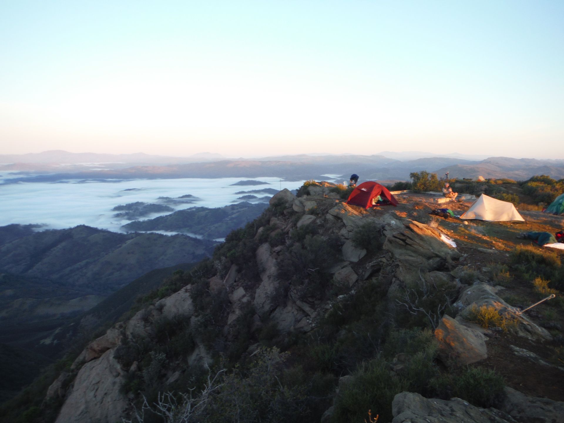
There are many views along the trail to Snow Mountain

Berryessa Snow Mountain is blessed with many outstanding features: rare species, beautiful wildflowers, iconic animals, and steep canyons. There are many prominent points throughout the Monument which provide magnificent views. Here are some of our favorites.


Annie’s Trail is a loop trail that is accessed via Stebbins Cold Canyon. The western leg of the loop is along the ridgeline overlooking Lake Berryessa. Near the southern end, there is a short side trail that leads to a rock that appears to be hanging off the ridge – Annie’s Rock. This is a great place for lunch or to take short rest. From this point on a clear day, hikers can see Berryessa Peak, Mount Konocti, Cobb Mountain, Cedar Roughs, and Snow Mountain

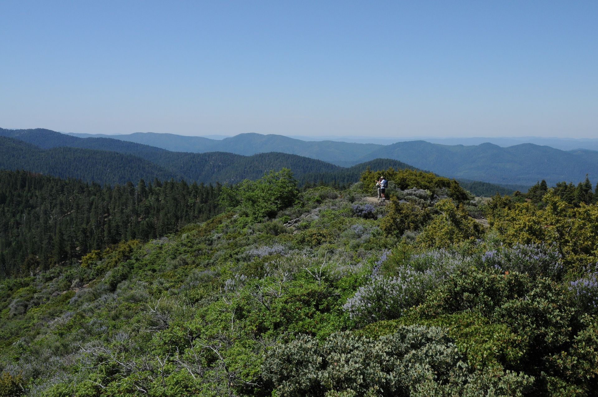
Morning on Berryessa Peak

For those that like to earn their beautiful views, look no further than Berryessa Peak and Snow Mountain (the two peaks that provide the name to Berryessa Snow Mountain National Monument). The hike to Berryessa Peak is just over 7 miles but is uphill, mostly exposed, has no water, and is an out-and-back trail. Looking west from Berryessa Peak, you see most of the reservoir as well as Cobb Mountain and Mount Konocti. To the east, Capay Valley is visible with the Sacramento Valley and Sierra Nevada in the distance. Snow Mountain is the highest point in the Monument. Views from the top are great but there are multiple vantage points along the trail to the top (Summit Springs is the shortest hike).


I must include the trail that is named after its views: Valley Vista Regional Park. This Yolo County Park is located north of Rumsey where CA-16 enters the Cache Creek canyon. Tuleyome worked with the County to build trails in the park. The initial trail rewards hikers with views of Capay Valley stretching to the south. Newly constructed trails now provide hikers with views of Cache Creek as it winds through the canyon.

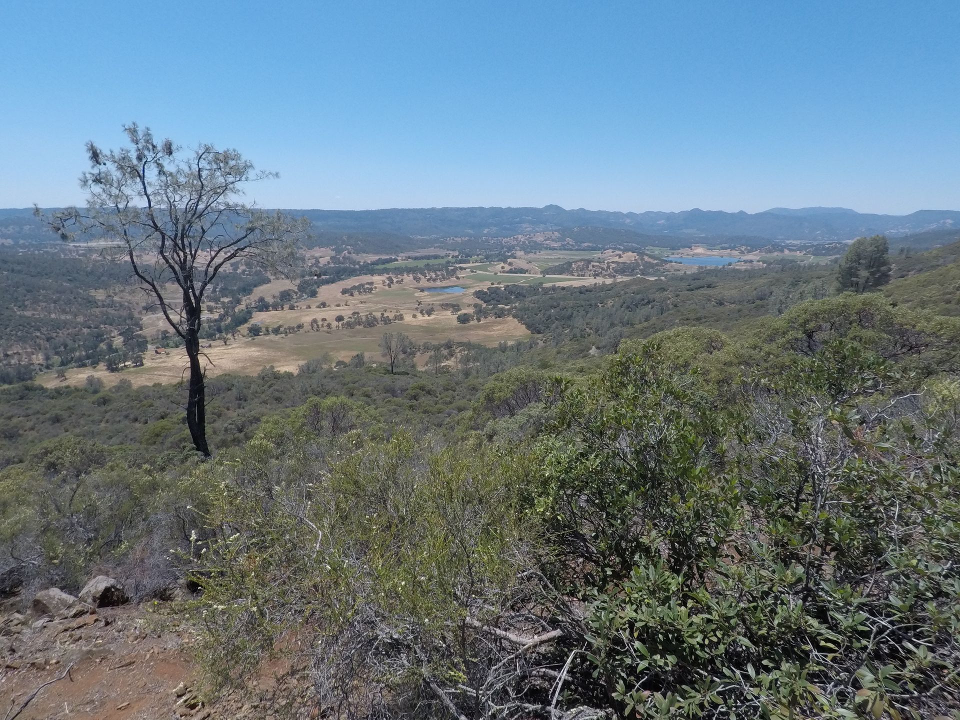
Pope Valley from Pope-to-Putah Trail

These four viewpoints are located within the boundaries of Berryessa Snow Mountain National Monument. However, the region around the Monument has some spectacular views as well. Pope-to-Putah Trail (P2P), west of Lake Berryessa and just north of Cedar Roughs Wilderness, has a short side trail to a hill overlooking Pope Valley. This hill has no official name but is known as Walter’s Hill by those that helped build and maintain P2P. Great views of Lake Berryessa from the north are available along the North End Trail and at Eticuera Creek Day Use Area. Lastly, a good view of the entire length of the Monument is available from the top of Mount Konocti.


-Nate Lillge; nlillge@tuleyome.org


Adventures and Engagement Director


Certified California Naturalist

RECENT ARTICLES

By Nate Lillge October 2, 2025
Tuleyome was excited to be back in the field at Stebbins Cold Canyon Reserve. Volunteers installed a Chronolog station that will help monitor restoration efforts on the Blue Ridge Trail. This station - a post next to the trail that encourages hikers to take a photo - will help UC Reserve System document the changes at the site without large amounts of resources and time dedicated to monitoring. You can be a part of restoration efforts by taking a photo at the station. Thanks to our volunteers who joined us! Photos from the day are available on Flickr . Check out our website for more chances to help Tuleyome maintain trails! More information about Chronolog can be found on their website . There are currently two cameras at Stebbins - one monitoring big leaf maples and this one on the Blue Ridge Trail . Head to Stebbins and be a part of the restoration efforts!
By Geoff Benn October 2, 2025
Interns Diego, Ellen, and Rithika on the Rotary Pavilion at the Preserve Tuleyome is excited to welcome three new Horticultural Interns for Fall 2025! This is our second year offering this internship, where we pair college students with mentors at Woodland Regional Park Preserve to assist with projects including invasive plant removal, native plantings, and native species monitoring. This year’s cohort includes three UC Davis Environmental Science and Management majors – senior Diego Barraza and sophomores Ellen Jenkins and Rithika Warrier. They will be mentored by longtime Preserve volunteers Jennifer Hogan and Teri Barry. Over the course of the Fall Quarter, the interns will join volunteer crews for work days at the Preserve, providing opportunities for both skill development and networking. The Preserve, which opened to the public in May 2025, is a restored former landfill site that was developed into nature preserve to provide outdoor education opportunities and to protect the rare and endangered plants found on the site. The Preserve is a collaborative effort by the City of Woodland, Tuleyome, Yolo Habitat Conservancy, Rotary clubs, and other local organizations and volunteers. If you have any questions about the internship program or Tuleyome’s work at the Preserve, please contact Geoff Benn at gbenn@tuleyome.org.
By Bryan Pride October 2, 2025
Thank you to everyone who submitted comments on the proposed rescission of the Roadless Rule and the USDA reorganization. We've cycled through several comment periods over the recent months, including the current open comment period for the rescission of the Public Lands Rule . Your voices joined half a million people who participated in the Roadless Rule comment period with 99% of comments supporting protection of our forest by keeping them roadless. This level of engagement shows the administration that we the people are paying attention. But our work isn’t done. Even though we defeated Senator Lee’s amendment to sell off public lands in the Big Beautiful Bill, the administration is still pursuing that same goal through a more coordinated attack. The mass firing of federal employees, efforts to rescind the Roadless Rule , the Public Lands Rule , and the proposed reorganization of USDA create the conditions necessary for unprecedented extraction from and eventual sale of our public lands. What we're witnessing isn't a series of isolated policy changes, it's a coordinated strategy with the "Big Beautiful Bill" connecting each attack on our public lands. The Strategy The sale of public lands started with DOGE’s mass firing of thousands of experienced Forest Service rangers, BLM land managers, and National Park employees, dedicated public servants who had built expertise from boots-on-the-ground field work to policy development roles. The loss of these public servants also means the elimination of institutional knowledge of what sustainable land management looks like in practice. The administration then moved to make these cuts permanent by closing and selling federal office buildings. The Ukiah BLM office , which manages the Berryessa Snow Mountain National Monument was initially threatened with closure but was eventually removed from the list. Removing the land managers was only one part of the plan. The Big Beautiful Bill passed through Congress with devastating budgetary cuts and protocol mandates for public lands and national forests. The bill, now signed into law, mandates destructive logging quotas : 250 million board feet annually from National Forests and 20 million board feet from BLM lands, with annual quota increases through 2034. The bill also requires agencies to award 20-year logging contracts to private companies, locking in extraction commitments through 2046. Logging levels this high haven't been seen since the 1900s. While the Big Beautiful Bill is now law, agencies cannot implement these logging and extraction mandates unless existing protective regulations, the Roadless Rule and the Public Lands Rule, are rescinded. These rules prevent the Big Beautiful Bill’s quotas from being implemented, which strongly suggests why the administration is moving to eliminate them. The Roadless Rule has coexisted with national forest logging for 25 years. The Rule protects 58.5 million acres of sensitive forest by preventing new road construction in designated roadless areas, while allowing logging to continue in areas with existing roads. However, the mandatory extraction quotas in the Big Beautiful Bill require access to previously untouched, sensitive areas. Meeting these dramatically increased quotas means building roads through currently protected roadless areas. Rescinding the Roadless Rule is a prerequisite for implementing the Big Beautiful Bill’s mandates. The Public Lands Rule recognizes conservation as a legitimate form of multiple use alongside grazing, mining, logging and recreation. The Public Lands Rule hasn’t stopped these uses, it requires that these activities be managed sustainably to protect long-term land health. However, the mandatory extraction minimum in the Big Beautiful Bill prioritizes meeting quotas over sustainable management. Rescinding the Public Lands Rule removes the requirement to balance extraction with conservation, making it possible to prioritize extraction regardless of long-term impacts on public lands. The USDA reorganization completes the strategy by eliminating local expertise, moving California’s forest management out of state. With no local forester position to resist unsustainable quotas or provide expertise about our unique ecosystems, implementation of new extraction protocols becomes inevitable. The sequence reveals the coordination: eliminate the people who understand sustainable management, pass legislation mandating unprecedented extraction, then remove the regulatory barriers that would prevent implementation. Why This Matters Now The Big Beautiful Bill's extraction mandates are already law, but they cannot be implemented while protective rules remain in place. These rules alone make it nearly impossible for the administration to enforce the newly set and unprecedented logging quotas. The protective rules that would prevent devastating extraction practices are under attack. Without these regulatory protections, the already-passed mandates will transform our public lands in ways that may be irreversible. Help speak for our public lands and take action to protect conservation by signing on to Tuleyome’s petition opposing the rescission of the Public Lands Rule, and/or submit comments directly on the Federal Register , you have until November 10th. For more information on how to participate in the public comment process or other advocacy opportunities, contact Bryan Pride Breaking News: Federal Government Shutdown The federal government shut down at 12:01 AM on Wednesday, October 1, 2025. National Parks and public lands will remain open to the public, though each location will vary in the number of staff present. USFS and BLM will have reduced staff at both field offices and regional offices. Some staff will be furloughed, while others may be working without pay. Offices such as the Bureau of Reclamation have the ability to run and operate Lake Berryessa activities for at least two weeks due to their access to discretionary funds, this is not a reality for all agencies. It is fire season. The Department of Interior and Department of Agriculture both released contingency plans for the lapse in federal funding. Both plans state that personnel directly related to wildfire response will largely be exempt from furloughs. The DOI's plan said National Park Service employees involved in fire suppression or fire monitoring activities will not be furloughed. USDA's plan said that employees who respond to and prepare for wildland fires will not be furloughed. Furloughs will still affect employees who are red-carded, or have wildland fire incident qualifications, but whose wildfire duties are secondary to their primary duties . During the government shutdown, some services may not be available or will be delayed. With reduced ranger presence on public lands, take extra precautions: don't hike alone, let someone know your plans, and be sure to pack out what you pack in.