Tuleyome's Policy Corner - A Win for Conservation! The Bureau of Land Management's "Public Lands Rule"

Hekia Bodwitch • July 2, 2024

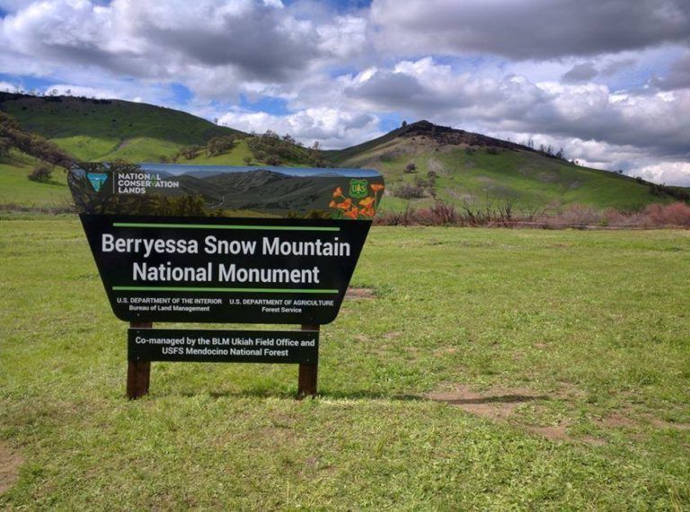
July 10, 2024 is the ninth anniversary of Berryessa Snow Mountain National Monument. To celebrate, we are sharing news about a recent win for conservation.


Last month, the Bureau of Land Management (BLM)’s “Public Lands Rule” went into effect. BLM is the nation’s largest land manager, managing 10% of the nation’s total landmass, including part of Berryessa Snow Mountain National Monument. As directed by the Federal Land Policy and Management Act (FLPMA), BLM is required to manage land for “multiple use and sustained yield.” The Public Lands Rule directs BLM to consider “conservation” as a “use” to manage for.


The Rule defines conservation as protection and restoration, and identifies tools BLM can use to achieve conservation. These tools include Area of Critical Environmental Concern (ACEC) designation processes, which BLM managers can apply to important resources and unique scenic landscapes. When an area becomes an ACEC, BLM must manage to protect its significance. ACECs were previously authorized through FLPMA, and the Rule clarifies steps BLM can take to implement them. The Rule also defines new tools for BLM to use to promote conservation. These new tools include restoration and mitigation leases, which BLM can issue to outside entities, including non-profits, to restore public lands or offset the impacts of a particular action. For example, a group such as Tuleyome could apply for a restoration lease that would enable the group to restore land in Berryessa Snow Mountain National Monument. When a restoration lease is in place, casual uses of the land for recreation, hunting and fishing, or research activities will generally be allowed. Restoration leases cannot be used to prohibit activities that are already allowed for in a region’s Resource Management Plan (RMP).


What’s next?


The Public Lands Rule holds implications for how BLM develops Resource Management Plans (RMPs), including the RMP for Berryessa Snow Mountain National Monument. For example, the Rule directs BLM to maintain an inventory of landscape intactness. When updating RMPs, BLM is to use a baseline condition of intactness as well as “available high quality information,” including Indigenous Knowledge, to: 1) identify intact landscapes; 2) evaluate alternatives to protect intact landscapes from degradation; and 3) determine which intact landscapes will be managed for protection. BLM intends to identify intactness through watershed condition assessments, an example of which can be found here.


The Rule represents an unprecedented mandate for BLM to advance conservation. However, BLM’s ability to implement the Rule, in management planning for Berryessa Snow Mountain National Monument and elsewhere, is contingent on adequate funding. In the coming weeks and months, Congress will determine BLM’s budget. As a result, the time is ripe to ask Congress to support BLM. **Click here** to send a letter to your representatives.


Not surprisingly, some are promoting legislation to challenge the Public Lands Rule. In April, the U.S. House of Representatives passed the Western Economic Security Today (WEST) Act, which would withdraw the Rule and prohibit BLM from implementing similar rules in the future. It is unlikely that this stand-alone bill will pass the Senate, but it is possible that WEST Act supporters will push similar proposals into a large government funding package. If this scenario unfolds, we will be calling on you to urge your Congressional representatives to protect the Public Lands Rule.


In the meantime, we thank the Biden Administration for establishing this historic legislation, and we look forward to working with BLM to help implement it. 


-Hekia Bodwitch (hbodwitch@tuleyome.org)

Policy Director

RECENT ARTICLES

By Bryan Pride February 11, 2026
In 2020, Governor Newsom committed California to an ambitious goal: conserve 30% of our lands and coastal waters by 2030. This “30x30” initiative isn’t just about setting aside more protected areas; it’s a comprehensive strategy to protect biodiversity, expand equitable access to nature, and build resilience to climate change across California’s diverse landscapes and waters. California has made meaningful progress towards the 30x30 goal. Currently, 24.4% of our lands and 16.2% of coastal waters meet the 30x30 conservation criteria, defined as areas that are durably protected and managed to sustain functional ecosystems and the diversity of life they support. But with less than five years remaining, we still need to conserve millions of additional acres to reach this critical goal. The Power In Nature Coalition No single organization can achieve 30x30 alone. That’s why Tuleyome is a proud member of the Power In Nature Coalition; a network made powerful by the collective work of over 250 community groups, conservation organizations, land trusts, and Indigenous organizations working together to conserve and protect the diverse landscapes of California. This statewide network coordinates advocacy, identifies priority conservation projects , and ensures that 30x30 implementation protects biodiversity, fosters meaningful relationships, and partners with state agencies and diverse communities. Power In Nature works on multiple fronts: defending conservation funding in state budgets, identifying potential 30x30 projects across California, and advocating for policies that support rather than undermine conservation progress. Power In Nature has multiple regional groups to elevate geographical priorities and empower local organizations to connect state-level policy to on-the-ground conservation work in their communities. Tuleyome’s Role in Advancing 30x30 At Tuleyome, our work protecting the Berryessa Snow Mountain National Monument directly contributes to California’s 30x30 goals. We’re actively engaged with Power In Nature’s Sacramento Valley regional group, as well as the Far North and Bay Area regional groups, helping coordinate conservation efforts across our region and connecting local priorities to statewide advocacy. Tuleyome has also participated in Power In Nature Advocacy Days, where we met with state elected officials to discuss policies and legislation that further or hinder the 30x30 conservation goals. How You Can Support 30x30 Whether you’re a landowner, community member, or fellow conservation advocate, there are many ways you can support 30x30 progress. There are multiple qualifying conservation lands that have not been added to the Conserved Areas Explorer and this is one of the many ways people can get involved to help track areas protected. If you’re interested in learning more about 30x30 activities in your region, check out the Power In Nature regional groups and sign up to attend monthly regional meetings or gain access to Power In Nature’s newsletter. Most importantly, through Power In Nature, you can make your voice heard by participating in local advocacy days or contacting your state legislators to encourage their support for full funding to conservation agencies and protection of environmental review processes. California’s commitment to conserve 30% of our lands and waters by 2030 is achievable, but only if we work together to make it a reality. If you have questions about how to get involved with 30x30 or Power In Nature, don’t hesitate to reach out! Bryan Pride Tuleyome Policy Director
By Kristie Ehrhardt February 11, 2026
You might already know that the Berryessa Snow Mountain National Monument (Monument) is a wonderland for birdwatchers. With a range of habitat types from aquatic, riparian, native grassland, oak woodlands, conifer forests to subalpine the range of species found in the Monument is staggering. If you prefer to break it down by county rather than habitat, western Colusa County boasts a birders paradise in Bear Valley and Lake County offers the shores of Clear Lake. Napa County showcases Quail Ridge Reserve and Lake Hennessey. Yolo County puts forth a plethora of hot spots including Putah Creek, Lake Solano, and the Cache Creek preserve which is home to Bald and Golden Eagles, Osprey and others! And, this is just a smattering of the treasure trove for bird nerds to enjoy in the nearly 345,000 publicly accessible acres of Monument. But, how do you know where and when to go to see what? Even if you’re an experienced birder, it can be overwhelming to know where and when to begin. I know people that travel to different states to check birds off of their “life list”. I also know people, some of them are those same people, that travel all over the globe to get a glimpse of a rare bird - or maybe it’s just rare to someone from Sacramento. Either way it’s enticing and rewarding to be part of a community with a common interest. There’s almost a secret code between birders. There’s definitely a code to name abbreviations and a spiffy way to keep count if you’re recording them. There’s also a way to estimate the number of birds in a flock but if you’re just wanting to sneak up on a feathered friend near or far, how do you know where to start? Try downloading the Cornell Lab eBird app. The app lets you input your own findings as well as investigate other people’s observations. You can base your search on your location or use a near or far location that you’d like to go explore. Or, you can browse by species and see exactly where to go to find them. The eBird app uses citizen science and operates similarly to the iNaturalist app, a favorite among biologists, naturalists and other interested folks. With the eBird app, you can contribute your sightings or even sound recordings to the community platform making it the largest birding community in the world. You can also create your own lists and have the app track them for you. The app not only makes birding more inclusive and interesting for individual birders but it is beneficial for the network of scientists as well. The combined data from the app helps conservationists understand how numbers of birds shift as well as aiding in developing genetic species distribution models that show where and when birds are in the region. This information helps develop and establish better conservation strategies for individual species and collective populations of birds. The app is easy, fun and rewarding for novice and veteran birders, conservationists, scientists and ultimately the birds themselves.
By Kristie Ehrhardt February 11, 2026
The Capay Valley Almond Festival has been a regional tradition since 1915. It showcases the Esparto/Capay Valley region and was originally held in the fall after the almond harvest was complete. Years later it was rescheduled to occur on the last Sunday in February to celebrate the almond trees while in blossom. The Almond Festival is the only local celebration that not only incorporates the dazzling landscape but it also honors five Capay Valley towns: Esparto, Capay, Brooks, Guinda and Rumsey. The 21-mile route along Highway 16 covers each town, offering their own unique ambiance and activities all while celebrating the almond bloom in Yolo County. You will also find local crafts, family fun, delicious food and other entertainment at each location. A bit about California’s almond history! Much like the European Starling’s initial introduction into the United States, the first attempt at almond production in California was not as glorious as anticipated. Almond trees were first planted in California as early as 1853 using European varieties that were not adapted for our climate conditions. Most of these subpar trees were either converted into other fruit trees or used for firewood. Even though the inaugural attempt wasn’t fruitful (haha, get it?), lessons were learned about cross pollination and where to plant the next go-around. Science happened and by the 1880’s other varieties were being cultivated and during the Citrus Fair in 1886, the two varieties that are still grown today were introduced. By the 1900’s cross pollination tactics advanced and were in place and our commercial production was on its way. This combined with the fact that almond trees were productive in soils that were too sandy for other fruit trees and could be prolific without the use of much artificial water, the crop finally seemed to be destined for success. During the twenty year span between the mid 1960’s and the mid 1980’s, irrigation methods advanced and became more available to land in the San Joaquin Valley, which held ideal conditions for almond production, creating a booming industry that still remains today. In 2020, 1.25 million acres of California were in almond production. We yield 2.8 BILLION (!) pounds of almonds which provides 100% of the United States commercial supply and over 80% of the world’s demand. Almonds are in the top five most valuable California exports bringing in almost five billion dollars.