


Tuleyome's Policy Corner - The San Pablo National Wildlife Refuge Expansion Act
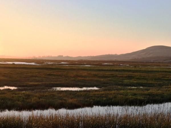
San Pablo Bay National Wildlife Refuge
There are many opportunities to protect our special places and their amazing cultural and natural diversity. And, our champions and partners are taking them.
In October, the California legislature passed SB 337, which ensconced in law the state’s goal of protecting 30% of California’s land and waters by 2030. We are well on our way to meeting that goal. As of May 2023, the State estimates that 24.4% of California’s lands and 16.2% of its coastal waters were conserved.
How are we going to get to 30%? By working together in partnership to protect our special places. There are many worthy efforts to make this happen – some new and some ongoing.
San Pablo National Wildlife Refuge Expansion Act Discussion Draft
Representatives, Garamendi, Huffman and Thompson have released a discussion draft of The San Pablo National Wildlife Refuge Expansion Act for feedback. The Act would 6,934 acres of lands belonging to the State of California and Sonoma Land Trust to the San Pablo National Wildlife Refuge. This would expand the Refuge by more than 28 percent, improve the long-term resiliency and biodiversity of the Refuge, help achieve our 30 X 30 goals and maintain recreational opportunities within the Refuge. The effort is supported by many, including the Coastal Conservancy, the Sonoma Land Trust, the California Waterfowl Association and Tuleyome.
The media release with links to the discussion draft and a proposed map can be found here.
What can you do?
You can submit feedback on the discussion draft legislation to Congressman Garamendi's office at San Pablo Bay National Wildlife Refuge Act Survey. The 90-day deadline for public comment is December 12, 2023.
Molok Luyuk
Tuleyome is still working hard with our partners – landowners, businesses, community members, local, state and federal representatives, recreationists and tribes – to protect Molok Luyuk. And, we’ve made great progress, having garnered support from tens of thousands of individuals, numerous elected officials and dozens of organizations. But we have more to do. We need your support also.
What can you do?
You can:
- Send a letter of support to the President, letting him know you want him to protect Molok Luyuk. Individual letters are always best. Here’s a sample in case it’s helpful. If you do send your own letter, please share it with Tuleyome – we are gathering up support.
- If you’re just too swamped to do an individual letter, then sign our petition in support of Molok Luyuk.
- Get to know and love the area even more – join us on a hike or come build a trial. Check out our Events page for upcoming adventures.
- If you have extra time and want to volunteer, contact us and dive in.
Thanks for all that you do to protect California’s special places. Hope to see you on the trails!
Cheers, Sandy

RECENT ARTICLES


