Policy Corner: Congress Is Using a Little-Known Law to Remove Your Voice from Public Land Management

Bryan Pride • March 5, 2026

Just months after we rejected the notion of selling off our public lands, some in Congress are at it again. This time, the attack is more calculated; bypassing the communities, tribal nations, and local stakeholders who spent years shaping how our public lands are managed. Whether you hunt, fish, farm, hike, or simply love the outdoors, Congress is now overriding your voice and threatening the legal foundation that protects your access to these lands. 


What is the Congressional Review Act?


The Congressional Review Act (CRA) was passed in 1996. It required that all federal agency “rules”  be submitted to Congress and gave Congress 60 days to pass legislation to disapprove the rule. If Congress takes no action, the rule goes into effect. For nearly 30 years, the CRA was used sparingly, only used to review federal regulations.


But Congress has now started using the CRA in a new and unprecedented way: to overturn Bureau of Land Management
Resource Management Plans (RMPs) and National Monument Management Plans; the blueprints that guide how our public lands are managed and protected. 


Resource Management Plans (RMPs) and National Monument Management Plans aren’t just paperwork. They are the result of years of public engagement that include tribal consultation, community input and scientific analysis that determine how millions of acres of public land are used and protected. These plans govern everything from recreation use and grazing permits to oil and gas leases, conservation designations, and wildfire management. 


Why this is everyone’s problem 


For decades, neither BLM nor Congress considered these plans to be “rules” subject to congressional review. They were understood as long-term planning documents: overarching  guidance for how agencies managed land, embracing principles appropriate to the particular lands and their characteristics. Land management plans have never, in the 50 years we’ve been preparing and following them, been considered rules. That is, not until this Congress. 


Since October 2025, Congress has rescinded
five BLM management plans covering tens of millions of acres in Alaska, Montana, and North Dakota and overturned a decision that protected the 
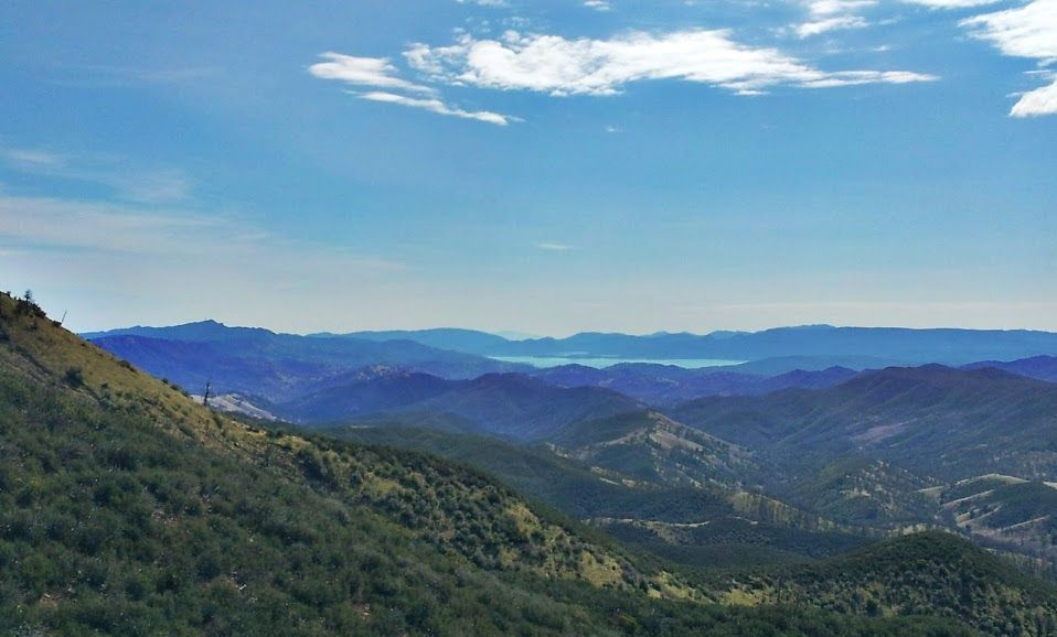
Arctic National Wildlife Refuge from oil and gas leasing. By treating these plans as “rules” subject to the CRA, Congress has called into question the legal validity of every management plan finalized since 1996. At threat are 123 BLM plans and 176 active Forest Service plans covering over 166 million acres, 14 of them are in California, including those governing Berryessa Snow Mountain National Monument and other lands in the region


An Attack on One Monument is an Attack on All 


The CRA threat has now reached our National Monuments. As of February 26, 2026, Senator Mike Lee formally began the process of fast-tracking the destruction of the Grand Staircase-Escalante National Monument Management Plan in Utah, the first time the CRA has ever been applied to a National Monument. 


The Grand Staircase-Escalante National Monument Management Plan took years to develop. BLM engaged in extensive government-to-government consultation with tribal nations who have lived in and around the monument since time immemorial; nations whose ancestral cultural sites are woven throughout the monument’s 1.9 million acres. Local governments, ranchers, outfitters, scientists, conservationists, and community members all had a seat at the table. The result is a plan that balances wildlife protection, outdoor access, dark night skies, grazing, and cultural preservation, reflecting the full breadth of what makes Grand Staircase-Escalante, known as the “Science Monument”, so remarkable. 


What makes the decision particularly alarming is the irreversibility. Once Congress rescinds a management plan under the CRA, BLM is barred from issuing another plan that is “substantially the same.” without
another act of Congress. 


Years of tribal consultation, community collaboration, and scientific analysis cannot simply be redone, and the protections that came from that work cannot be easily restored. The monument’s geology, fossils, wildlife habitat, grazing access, and cultural resources would all be left in a management vacuum, vulnerable to illegal vehicle use, landscape-level clearcutting of native pinyon-juniper forests, and unchecked extractive activities. 


This is the pattern. What happens in Utah, Alaska, Montana, and North Dakota today sets the precedent for what can happen at Berryessa Snow Mountain National Monument and every other monument. Once Congress establishes that Monument Management Plans are fair game to be overridden through congressional review, no monument, no matter how beloved, no matter how many years of work went into its protection is truly safe. An attack on one monument is an attack on all of them. 


What Tuleyome is doing about it


We’re working with a nationwide coalition to prevent further misuse of the CRA. We are supporting legislation clarifying that land management plans are not subject to the CRA. We are ensuring that our elected officials know how much the public supports public lands and wants them protected. 


We are committed to fighting back, working alongside community members, tribal nations, and coalition partners to keep our public lands in public hands.


We will continue to monitor developments and keep you informed. 


What you can do about it. 


Contact your representatives
and let them know that public lands belong to all of us, and decisions about how they are managed should stay rooted in our communities, not decided in Washington D.C. Ask them to vote against resolutions that use the CRA to roll back our resource management or monument management plans.


Monitor Tuleyome’s social media to stay up to date on fast moving issues and see how you can help. Connect with efforts to protect the Grand Staircase-Escalante National Monument Management Plan. Stay tuned. We’ll let you know what’s happening and how you can make a difference.


RECENT ARTICLES

By Kristie Ehrhardt April 9, 2026
Have you ever been hiking in the Berryessa Snow Mountain National Monument (or almost anywhere else in the world for that matter) and come across a plant or animal and not been able to identify it? Have you ever thought, “hmmm, if only there was an easily accessible phone app that could help me identify this thing nearly instantly?” If that exact thought wandered through your cranium; boy, oh boy are you in luck! Enter iNaturalist! The iNaturalist app is primarily an online social community sharing their findings and information to network and help others learn about the environment. The iNaturalist website states that “INaturalist is crowdsourced species identification system and an organism occurrence recording tool. You can use it to record your own observations, get help with identifications, collaborate with others to collect this kind of information for a common purpose, or access the observational data collected by other iNaturalist users.” iNaturaist was developed as a Master’s final project by Ken-ichi Ueda, Nate Agrin and Jessica Kline at UC Berkeley’s School of Information back in 2005; the same year that YouTube and Reddit were initially introduced to the public - a vintage year for social media developments! It officially launched in 2008 and work continued on the site and iNaturalist, LLC was born in 2011. By 2017 National Geographic was onboard and in 2023, what began as a student project became an independent nonprofit organization that grew into a globally recognized Citizen Science driven platform that connects millions of people to the biodiversity around them. iNaturalist is a compilation database that contributes valuable collective intelligence to conservation and science from around the world. iNaturalist is a valuable tool for species identification as well as organism occurrence crowdsourced information, it is also a practical resource for species identification and distribution. And guess what else! It’s free to use. Sound good? Want to know how you can benefit from iNaturalist? You can use iNaturalist to record your own species observations and locations. You can use it to help identify species you aren’t sure about or may be new to by using other individuals' entries. You can even work with other users to collaborate and continue to add information to the site or you can access other’s information regarding species observations and occurrences. You can look up and enter data using scientific nomenclature or common names. You can look at other’s photos and locations for reference and contribute your observations. Students and Professors alike are using and recommending iNaturalist. So how’s it been going? On March 20, 2008, the very first entry was made into iNaturalist. To save you from doing the math I’ll tell you that iNaturalist just had its 18th birthday! Guess how many observations people have recorded in those 18 years… you’ll never guess so I’ll just tell you - iNaturalist has over 3.5 million individual observations ! And it’s increasing every moment, you can literally watch the counter on their homepage rise. Guess how many individual species have been recorded! Not to be disparaging but you’ll never get it...iNaturalist is up to just under 560,000 species ! There are currently over four million registered individuals making and recording observations and more than 483,000 people helping other people by making identifications. In just 18 years, a student project has grown into a globally recognized and respected tool to make and record species observations adding information to a world-wide biodiversity database. If you want to be a part of this community simply download the iNaturalist app or go to their website and get out there and start entering your observations. The Berryessa Snow Mountain National Monument region is an incredible place to practice using iNaturalist because it hosts such a huge diversity of habitats and species.
By Kristie Ehrhardt April 9, 2026
I’m sure a lot of us already know the danger that foxtails pose to our dog and cat friends and hopefully nobody reading this minds, but I’d like to try extra hard to make sure that everyone reading this knows about the menacing nature of foxtail barley. Foxtail barley ( Hordeum sp.) is a member of the grass (Poaceae) family and is native (I just learned this!) to North America. Although it is a native species, it is considered “weedy” because it readily establishes and can outcompete other species because it thrives in both moist and drought prone environments. It is also known by other cute little woodland creature names such as squirreltail barley, bobtail barley and skunktail barley but lemme tell you, it’s not as endearing as the common names suggest. The name “foxtail” is a general term for grasses in the Hordeum (barley genus). Foxtail barley (foxtail) is a perennial bunch grass that thrives in previously disturbed areas and is somewhat unique in that it is tolerant of saline and/or alkaline soils where the majority of other upland species cannot survive. Foxtails can germinate in the spring or the fall and those that germinate in the fall resume growing early the following spring often outcompeting other spring germinating plant species. Because it is salt tolerant it can be found on coastal beaches and along the edges of brackish and salt marshes as well as road sides, yards and fields. Foxtail usually doesn't exceed one three feet tall when left undisturbed but if the plants are mowed, they can flower and produce seed much closer to the ground as well. Seed heads are pale green and appear as a square-shaped (characteristic of barley) bushy spike. The stems are erect with soft blue-ish gray-green rolled leaves and seed heads have long awns. Since plants can’t get up and wander about, they need a method to disperse their seeds. That method for foxtails is mainly by hitchhiking on other things that move from one location to another. Up close, individual seeds look like a fox’s bushy tail and their shape helps them to attach to your pets and you. And because the seeds are barbed, they can get embedded in our furry friend’s ears, eyes and skin and often requires a vet’s steady hand (and your pocketbook) to remove them. They can be especially dangerous and sometimes fatal if they get into your pets nose or blood stream. Right now, at least for a few more days, the foxtails are still green and soft. But, as the temperatures rise and the vegetation begins to dry out, the hazards posed by foxtails begin to rise with the mercury. As the seed heads mature they become golden in color and very fragile. This is when they are the most dangerous to our pets as they are easily broken apart from the plant. Eventually the seeds get harder and drop to the ground where if stepped on they can embed themselves into your bare feet or your pet’s paws. Although it seems nearly impossible to avoid foxtails there are some ways to help you and your furry buddy continue to enjoy hiking through the Berryessa Snow Mountain National monument or a leisurely stroll through your neighborhood. Avoid areas where you’ve seen foxtails before and pay attention to where your friend wanders - especially during the summer months when the foxtails are dry and brittle Keep your dog’s fur trimmed and short so there’s less surface for the seeds to attach to Do a quick nose to tail check for foxtails after each walk or hike being sure to check between their foot pads A basket muzzle may help keep their nose and mouth clear of foxtails while still allowing your pup to pant If your furry friend is coughing, gagging, sneezing, snorting or pawing at their face or ears or limping, there may be an embedded foxtail that you aren’t able to see. It’s best to have them checked out by a vet to make sure they are all clear. If they have picked up a foxtail, removing it as soon as possible is usually less invasive for your companion and your wallet. Just by spending a little extra time and effort, you and your pets can still Enjoy Outside even during foxtail season!
By Kristie Ehrhardt April 9, 2026
Finally, they’re back!! I’ve been waiting and watching for them and just this week I heard the first one of the summer. Swainson’s hawks ( Buteo swainsoni ) make an impressive journey every fall and then do it again in reverse every spring. Where do they go and why is it so impressive you ask? Stay tuned and find out! Our Swainson’s hawks, the hawks that summer here in California’s Central Valley, that raise their babies in old cottonwoods and valley oaks along our riparian areas, the same hawks that weigh less than two pounds and gorge themselves on grasshoppers and rodents all summer long, travel all the way to ARGENTINA! That is nearly 6,500 air miles and would take 18-20 hours on a commercial flight without any layovers. Are you impressed? If not, consider the fact that they do that epic journey TWICE a year! Swainson’s hawks are a close relative of our year-round resident, the Red-tailed hawk and are similar in size and habitat requirements. Swainson’s hawks have two color morphs; a light morph and a dark morph, and although both sexes wear the same colors and patterns, females are typically slightly larger and heavier than males. In the light color morph both females and males sport a chocolate-colored “bib” with a white throat and face patch and bright yellow rostrum. Their tails are barred and their flight feathers are dark with a light-colored leading edge - a unique color pattern in North American raptors. Dark morphs are all dark chocolate brown with the same barred tail with a light patch just under it. Swainson’s hawks occur roughly west of the Missouri River during the warm summer season and like some people I know, take off for warmer regions when the summer weather turns chilly. In California, Swainson’s hawks nest primarily in the Central Valley although there are small populations in northeastern California, Shasta Valley, Owens Valley and the Mojave Desert. Historically it was estimated that California supported over 17,000 breeding pairs but in 1980 that number had declined to only 375 breeding pairs. In 1988 it was up to an estimated 550 breeding pairs statewide and in 2005 the number of breeding pairs had inched up to just under 2100. They were listed as a threatened species in California in 1983 due primarily to habitat loss.  An endorsement of their adaptability, Swainson’s hawks have not only learned to co-exist with many agricultural practices but they in fact thrive alongside irrigated pastures and tractors which has helped their number improve. Swainson’s hawks have learned that the rumble of a tractor pulling a harrow disk equates to what we might consider a drive through meal. They’ve also learned that when a rancher turns on the water and begins to flood irrigate a pasture, that advancing waterline flushes out underground rodents resulting in a heavenly smorgasbord of unwelcome pests to the human behind the water controls. I’ve seen 20 hawks lined up following the waterline with 20 more circling waiting their turn at the chow line. If their migratory journey hasn’t impressed you, their rodent/lizard/grasshopper eating capacity surely will. These gourmands will gorge themselves so heavily that they realistically cannot lift themselves off the ground for a time which results in oodles of hawks hopping about like unathletic feathered toads. Mutualism at its finest - the hawks get a gourmet meal and farmers and ranchers get free pest control. If their stamina and gluttony doesn’t impress you, maybe this will. It’s not uncommon for wild Swainson’s hawks to live and continue breeding into their 20’s. But that’s not just hanging around and raising babies in the laid back summer months. During those 20 years, that individual bird has flown about 260,000 miles to safely return to the same area, perhaps the same tree, that held the nest that it fledged from. That’s undeniably impressive!