Science Corner - California's Biodiversity!

Kristie Ehrhardt • September 11, 2025

The term biodiversity refers to the medley of life on Earth.  California is one of only 36 global regions that are so incredibly biologically rich and ecologically significant that they are called biological hotspots. A biological hotspot is defined as an area containing exceptional concentrations of endemic (found nowhere else on Earth) plants and wildlife species that are experiencing profound rates of loss. Combined, the 36 identified biodiversity hotspots encompass only three percent of the entire Earth’s surface.


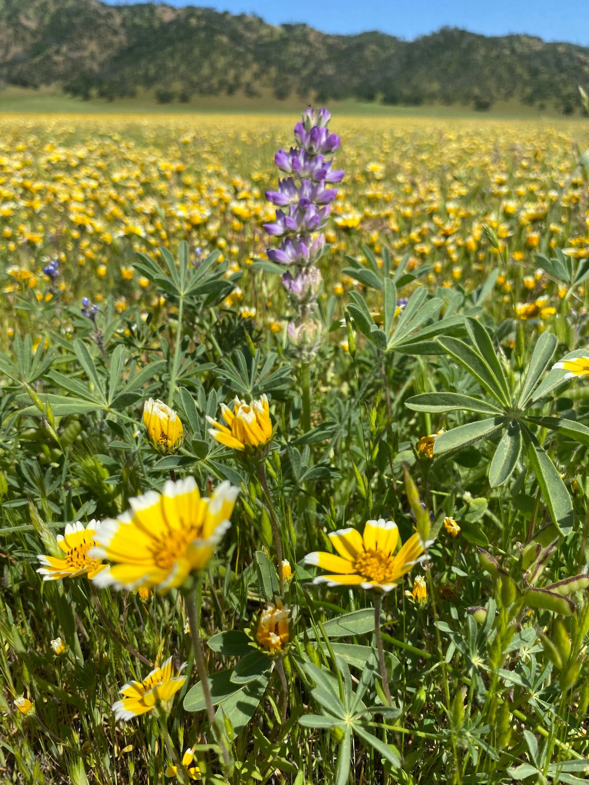
If I’m being shamefully honest, from time to time when I think about California I picture the construction on Highway 50, Sacramento International Airport or Disneyland.  But get out of suburbia and you can’t help but appreciate the ecological treasure that California is. We have high and low deserts, we have mountain tops that were once on the ocean floor, some that were shaped by glaciers and one volcano that erupted as recently as the early 1900’s. We have fertile farmland, grasslands, oak woodlands and conifer forests. Our coast lines range from rocky with harsh waves to soft, sandy beaches. We host the lowest elevation (which coincidentally also happens to be the hottest place on the Earth) and the highest elevation - both within the contiguous 48 states. California is home to the most massive trees, the tallest trees and the oldest trees in the world. We boast stunning wildflower displays and vernal pools with flora and fauna found nowhere else on Earth. I could go on and on…


Now, think of the diverse ecosystems found in these regions. Think about what organisms they support from microscopic bacteria and fungi to Black Bears and Northern Elephant Seals and everything in between. California not only has the highest number of species of any state in the US but it also has the highest number of endemic (those only occurring here) species of all the United States.  We have over 1,000 species of native vertebrates with 65% of those being found only in California, over 6,500 species of plants with over 2,000 species endemic to California, 52 species of cone bearing trees with 14 of those being endemic and 30,000 species of insects with over 1,600 species of native bees which are exceptionally important to our agricultural industry. California is the epitome of BIODIVERSITY.


A bit more bragging on California - our great state also supports over 30% of all the plant and vertebrate species in all of the United States but sadly, roughly 30% of our species are threatened by extinction. California 30x30, a statewide initiative to conserve 30% of California’s lands and waters by the year 2030. You can also help celebrate California’s biodiversity by participating in California Biodiversity Day on September 7, 2025. But! The party doesn’t stop there, you can participate in events the entire week of September 6 through the 14th. Click
here to find a list of events, including Tuleyome’s Bio Blitz for the Berryessa Snow Mountain National Monument! You don’t have to travel to celebrate though, you can go look for spiders in your backyard or birds in a nearby park. Each of your observations and photos entered into iNaturalist helps enrich the database for the 30x30 initiative! 


Also, just in case you were wondering…

  • The high deserts of California include the Mojave with its iconic Joshua Trees and the Great Basin which gets most of its precipitation from snow. High deserts are characterized by cold nights and hot and windy days. 
  • California’s low desert is the Sonoran desert which is hot, receives monsoonal moisture and is characterized by the presence of the saguaro cacti.
  • Snow Mountain was once a mid-ocean seamount (an underwater volcano). As tectonic plates moved around, one slid under the other (subduction) and the seamount was buried. Later tectonic forces brought the volcano back to the surface which is what we know today as the “island in the sky”.
  • Lassen Peak was the most recent volcanic eruption to occur in California from 1914-1917.
  • There are others but perhaps one the most notorious (or maybe it’s just my favorite) mountains displaying glacial erosion is Half Dome in Yosemite National Park. 
  • Death Valley is not only the hottest place on Earth, it also has the distinct honor of being the hottest, driest and lowest (282 feet below sea level) place in North America. Who’s up for a road trip? It’s actually an extremely special place and you should visit but please research and plan ahead!
  • Mount Whitney is the highest peak in the continental United States at 14,505 feet above sea level.
  • The most massive trees in the world are the Giant Sequoias
  • The tallest trees in the world are the Coastal Redwoods
  • The oldest trees in the world are the Bistlecone Pines 


-Kristie Ehrhardt (kehrhardt@tuleyome.org)

Tuleyome Land Conservation Program Manager

RECENT ARTICLES

By Bryan Pride February 11, 2026
In 2020, Governor Newsom committed California to an ambitious goal: conserve 30% of our lands and coastal waters by 2030. This “30x30” initiative isn’t just about setting aside more protected areas; it’s a comprehensive strategy to protect biodiversity, expand equitable access to nature, and build resilience to climate change across California’s diverse landscapes and waters. California has made meaningful progress towards the 30x30 goal. Currently, 24.4% of our lands and 16.2% of coastal waters meet the 30x30 conservation criteria, defined as areas that are durably protected and managed to sustain functional ecosystems and the diversity of life they support. But with less than five years remaining, we still need to conserve millions of additional acres to reach this critical goal. The Power In Nature Coalition No single organization can achieve 30x30 alone. That’s why Tuleyome is a proud member of the Power In Nature Coalition; a network made powerful by the collective work of over 250 community groups, conservation organizations, land trusts, and Indigenous organizations working together to conserve and protect the diverse landscapes of California. This statewide network coordinates advocacy, identifies priority conservation projects , and ensures that 30x30 implementation protects biodiversity, fosters meaningful relationships, and partners with state agencies and diverse communities. Power In Nature works on multiple fronts: defending conservation funding in state budgets, identifying potential 30x30 projects across California, and advocating for policies that support rather than undermine conservation progress. Power In Nature has multiple regional groups to elevate geographical priorities and empower local organizations to connect state-level policy to on-the-ground conservation work in their communities. Tuleyome’s Role in Advancing 30x30 At Tuleyome, our work protecting the Berryessa Snow Mountain National Monument directly contributes to California’s 30x30 goals. We’re actively engaged with Power In Nature’s Sacramento Valley regional group, as well as the Far North and Bay Area regional groups, helping coordinate conservation efforts across our region and connecting local priorities to statewide advocacy. Tuleyome has also participated in Power In Nature Advocacy Days, where we met with state elected officials to discuss policies and legislation that further or hinder the 30x30 conservation goals. How You Can Support 30x30 Whether you’re a landowner, community member, or fellow conservation advocate, there are many ways you can support 30x30 progress. There are multiple qualifying conservation lands that have not been added to the Conserved Areas Explorer and this is one of the many ways people can get involved to help track areas protected. If you’re interested in learning more about 30x30 activities in your region, check out the Power In Nature regional groups and sign up to attend monthly regional meetings or gain access to Power In Nature’s newsletter. Most importantly, through Power In Nature, you can make your voice heard by participating in local advocacy days or contacting your state legislators to encourage their support for full funding to conservation agencies and protection of environmental review processes. California’s commitment to conserve 30% of our lands and waters by 2030 is achievable, but only if we work together to make it a reality. If you have questions about how to get involved with 30x30 or Power In Nature, don’t hesitate to reach out! Bryan Pride Tuleyome Policy Director
By Kristie Ehrhardt February 11, 2026
You might already know that the Berryessa Snow Mountain National Monument (Monument) is a wonderland for birdwatchers. With a range of habitat types from aquatic, riparian, native grassland, oak woodlands, conifer forests to subalpine the range of species found in the Monument is staggering. If you prefer to break it down by county rather than habitat, western Colusa County boasts a birders paradise in Bear Valley and Lake County offers the shores of Clear Lake. Napa County showcases Quail Ridge Reserve and Lake Hennessey. Yolo County puts forth a plethora of hot spots including Putah Creek, Lake Solano, and the Cache Creek preserve which is home to Bald and Golden Eagles, Osprey and others! And, this is just a smattering of the treasure trove for bird nerds to enjoy in the nearly 345,000 publicly accessible acres of Monument. But, how do you know where and when to go to see what? Even if you’re an experienced birder, it can be overwhelming to know where and when to begin. I know people that travel to different states to check birds off of their “life list”. I also know people, some of them are those same people, that travel all over the globe to get a glimpse of a rare bird - or maybe it’s just rare to someone from Sacramento. Either way it’s enticing and rewarding to be part of a community with a common interest. There’s almost a secret code between birders. There’s definitely a code to name abbreviations and a spiffy way to keep count if you’re recording them. There’s also a way to estimate the number of birds in a flock but if you’re just wanting to sneak up on a feathered friend near or far, how do you know where to start? Try downloading the Cornell Lab eBird app. The app lets you input your own findings as well as investigate other people’s observations. You can base your search on your location or use a near or far location that you’d like to go explore. Or, you can browse by species and see exactly where to go to find them. The eBird app uses citizen science and operates similarly to the iNaturalist app, a favorite among biologists, naturalists and other interested folks. With the eBird app, you can contribute your sightings or even sound recordings to the community platform making it the largest birding community in the world. You can also create your own lists and have the app track them for you. The app not only makes birding more inclusive and interesting for individual birders but it is beneficial for the network of scientists as well. The combined data from the app helps conservationists understand how numbers of birds shift as well as aiding in developing genetic species distribution models that show where and when birds are in the region. This information helps develop and establish better conservation strategies for individual species and collective populations of birds. The app is easy, fun and rewarding for novice and veteran birders, conservationists, scientists and ultimately the birds themselves.
By Kristie Ehrhardt February 11, 2026
The Capay Valley Almond Festival has been a regional tradition since 1915. It showcases the Esparto/Capay Valley region and was originally held in the fall after the almond harvest was complete. Years later it was rescheduled to occur on the last Sunday in February to celebrate the almond trees while in blossom. The Almond Festival is the only local celebration that not only incorporates the dazzling landscape but it also honors five Capay Valley towns: Esparto, Capay, Brooks, Guinda and Rumsey. The 21-mile route along Highway 16 covers each town, offering their own unique ambiance and activities all while celebrating the almond bloom in Yolo County. You will also find local crafts, family fun, delicious food and other entertainment at each location. A bit about California’s almond history! Much like the European Starling’s initial introduction into the United States, the first attempt at almond production in California was not as glorious as anticipated. Almond trees were first planted in California as early as 1853 using European varieties that were not adapted for our climate conditions. Most of these subpar trees were either converted into other fruit trees or used for firewood. Even though the inaugural attempt wasn’t fruitful (haha, get it?), lessons were learned about cross pollination and where to plant the next go-around. Science happened and by the 1880’s other varieties were being cultivated and during the Citrus Fair in 1886, the two varieties that are still grown today were introduced. By the 1900’s cross pollination tactics advanced and were in place and our commercial production was on its way. This combined with the fact that almond trees were productive in soils that were too sandy for other fruit trees and could be prolific without the use of much artificial water, the crop finally seemed to be destined for success. During the twenty year span between the mid 1960’s and the mid 1980’s, irrigation methods advanced and became more available to land in the San Joaquin Valley, which held ideal conditions for almond production, creating a booming industry that still remains today. In 2020, 1.25 million acres of California were in almond production. We yield 2.8 BILLION (!) pounds of almonds which provides 100% of the United States commercial supply and over 80% of the world’s demand. Almonds are in the top five most valuable California exports bringing in almost five billion dollars.