By Kristie Ehrhardt
•
January 20, 2026
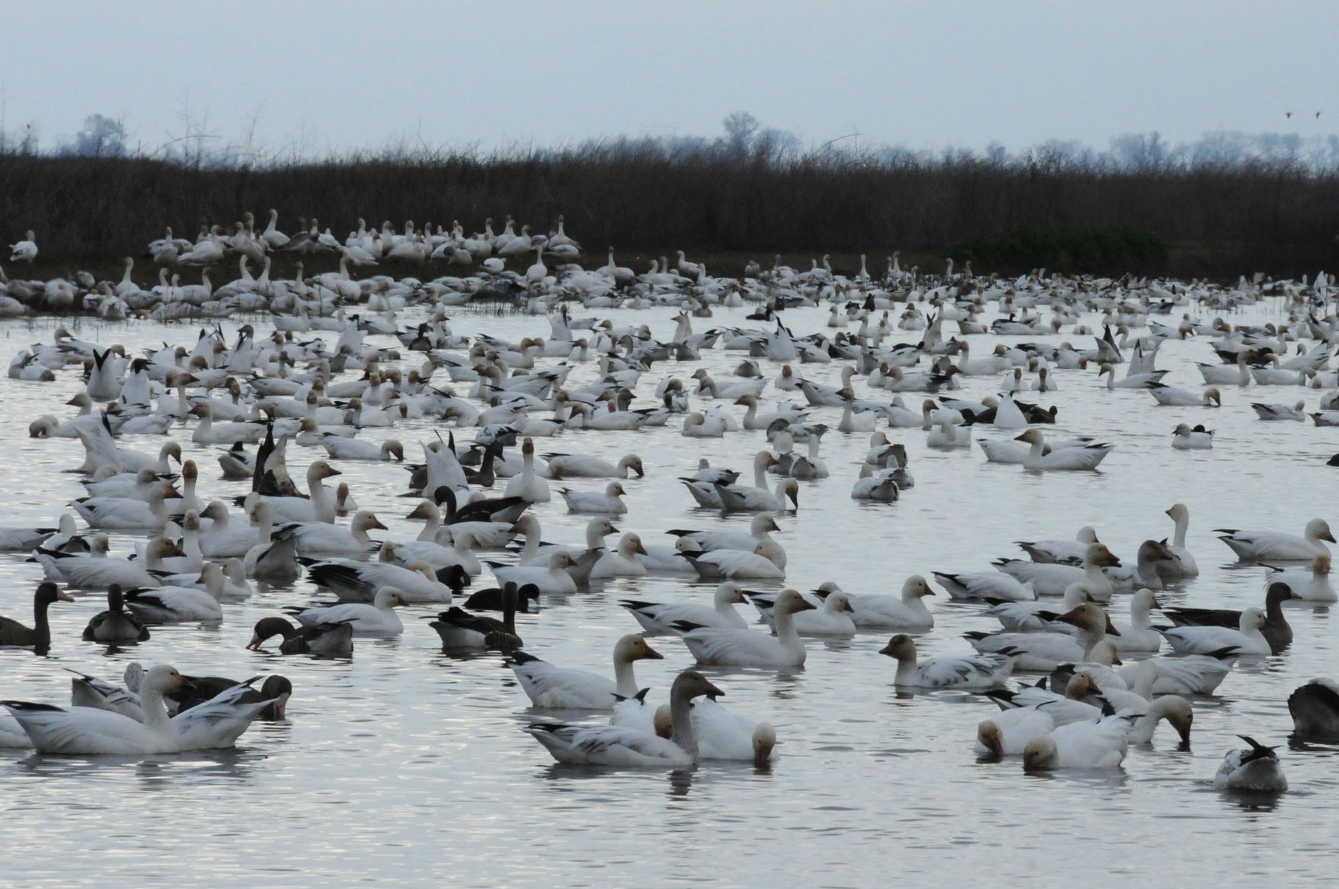
Stretching from the Bering Straight off the coast of Alaska south to majestic Patagonia, the Pacific Flyway is one of the paramount migratory pathways in the entire world. Hundreds of species ranging from tiny hummingbirds, songbirds like sparrows and warblers, shorebirds like avocets, sandpipers and whimbrels, waterfowl including many species of ducks and geese to great Bald Eagles combine to equal the billions of birds that use the Pacific Flyway each migration season. With California's mild winters, available wetlands and flooded rice fields, and oodles of food, it’s not hard to see why waterfowl species like the striking white and black Snow Goose spend their winters here. As many as a million and a half Snow Geese will be using the Pacific Flyway and tens of thousands of them will remain here, in our region, for the winter. The City of Chico and surrounding communities come together to celebrate “this magnificent spectacle of nature with the Snow Goose Festival of the Pacific Flyway.” By connecting and showcasing artists, authors, educators, guides and volunteers the festival aims to excite and unite the community by increasing appreciation, awareness, conservation and understanding of the resident and visiting wildlife and their habitats in the Northern Sacramento Valley. The three day festival features art and an auction, a banquet, field trips, family activities and exhibits and workshops! Snow Geese (Anser caerulescens) breed in Greenland, Canada, Alaska and the northeastern tip of Siberia and winter in the warmer regions of southwestern British Columbia, south through the United States and Mexico. There are two color morphs, white which are called “snows” (shocking, I know) and the dark morphs which are called “blues”. Snows are all white with black wingtips while blues have dark bluish-gray plumage and a white head, neck and tip of the tail. Both color morphs have orangy-red legs and feet and a pink bill with black edges that makes it look like they are grinning. Sometimes minerals in the soil or water where they’re feeding can stain their white heads making them look orange. Snow Geese are vocal. Very vocal. Some may say they are extremely vocal and they can often be heard from more than a mile away. Frequently Snow Geese and Greater White-fronted Geese travel together as they are very similar in size and needs. Combined flocks of them can often be heard on winter days and nights as they fly high overhead to their feeding grounds. If you’re looking for a fun way to Enjoy Outdoors and learn more about the Pacific Flyway, Snow Geese and their fellow travelers, venture on up to Chico during the weekend of January 22-25, 2026. They’d love to see you at one of the many events! Please visit the website ( https://snowgoosefestival.org/ ) for a list of activities, to register and for more information. Snow Goose Fun Facts! When Snow Geese are resting or feeding, lookouts keep an eye to the sky watching for threats such as Bald Eagles or other predators which prey on old or injured geese. The lookout will vocalize and the entire flock may spontaneously take flight which is pretty stunning to watch. Snow Goose eggshells stain easily which makes aging the eggs easy, the older eggs will appear dirtier while the more recently laid eggs remain creamy white. Snow Geese populations dropped so low in the early 1900’s that hunting was no longer allowed in the eastern states. From the 1970’s and on, the population has boomed so much that some of their tundra nesting grounds are being impacted by their numbers. Once females arrive at their breeding grounds they may spend up to 20 hours a day foraging but consume nearly nothing once they begin incubating eggs. Snow Goose digestion is remarkably quick, requiring only about an hour or two to go from gullet to ground. Snow Geese make epic journeys by wing but they are not lazy on foot either. Within the first month after hatching, goslings may walk about 50 miles with their parents. When waterfowl molt they lose their ability to fly but a molting Snow Goose can outrun many predators. The oldest known Snow Goose was over 30 years old! Word Play. A group of geese on the ground or water is called a gaggle . That same collection of geese but now in the air are called a skein , a wedge or a team . Hunters use the term “ grind ” for an assemblage of geese while culinary artists use the same term to mean goose meat . BUT, if you simply call them a flock of geese, everyone will know what you’re talkin' about! -Kristie Ehrhardt ( kehrhardt@tuleyome.org ) Tuleyome Land Conservation Program Manager
