Summer Hiking in the Berryessa Snow Mountain National Monument Region

Nate Lillge • July 26, 2023

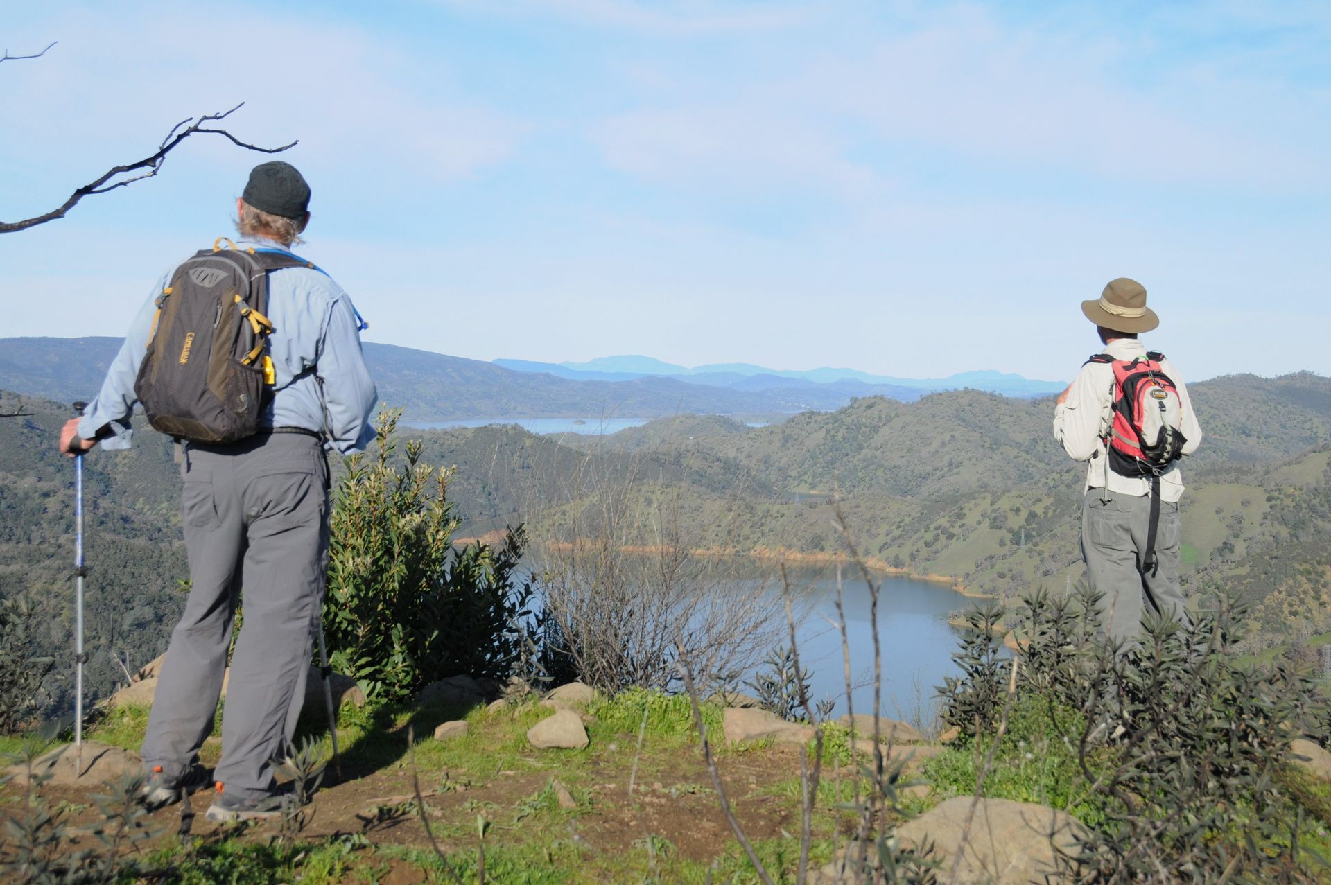
Bob Schneider and Bill Grabert looking at Lake Berryessa and Snow Mountain in the distance while hiking at Stebbins Cold Canyon

Bob Schneider, one of Tuleyome's co-founders and current member of Tuleyome's Advisory Council, and Bill Grabert, a Tuleyome staff member turned volunteer Tuleyome Board Member, co-authored the following Tuleyome Tale. Although it was written in 2020, the safety measures outlined are timeless and a good reminder given the current temperatures in the Berryessa Snow Mountain National Monument region.


This area gets HOT in the summer. Every year, in extreme heat of summer, there are rescues of hikers in our region. Heat and dehydration can be life threatening, but rescues, which put our emergency personnel at risk and keep emergency resources occupied, can be avoided with just a little planning and common sense. Hiking in the midst of summer is possible...here are some recommendations on how to hike safely.


Check the weather. Don’t hike on high temperature days. Take LOTS of water. Know your route. Be prepared to turn around when temps increase and water runs low.


Get out early. If you can be on the trail at sunrise, all the better. Take lots of water because you will be sweating it out. Perspiration is essential to keeping your body temperature regulated. In this area, very few of the trails have water nearby. Some no-water trails, like the difficult 14.5-mile Berryessa Peak trail, should simply not be attempted on a hot summer day unless you plan to carry a couple of gallons of water with you. Getting out on the trail extra early has the added benefit of avoiding most other people who start on the trail at 9:00 AM or so. On the hottest days, plan to be finished with your hike and off the trail by 11:00 AM.


There are two main ways to keep cool while you’re out on a hike: shade and evaporation. You can get shade from a tree, but you can also get it from a hat. Wear a hat! A lot of the trails around here are lacking in trees, but you will always have shade if you wear a nice broad hat. You don’t see it here very often, but an umbrella can also be helpful. The best evaporative cooling is natural perspiration and a little breeze. However, a nice trick on an extra hot day is to carry a mister spray bottle for extra cooling from time to time.


One way to learn about hiking and the hikes in our region is to first go with others. Tuleyome, the Sierra Club, and many “Meet Up” groups may offer hikes. Check them out. You will learn to enjoy the outdoors safely and you will meet fellow hikers.


Sometimes accidents do happen. We are truly fortunate to have dedicated public safety men and women who take time away from their families and incur personal risks to aid those in need. But let’s be sure that we take personal responsibility to avoid unnecessary rescues and do our best to let them enjoy their time at home. 


Top Twelve Safety Pointers:


Know where you are going – and let others know. There are maps online and trail books at outdoor stores. Plan your trip and let your family and friends know your plan. New hikers can first take trips with hiking groups in the region.

A whistle? Signal mirror? Cell Phone? It’s nice to be able to call for help when really necessary but keep in mind that often trails can be well out of cell phone range. Before you make that “rescue me” call, ask yourself: Is somebody injured? Is this a life-threatening emergency? Do I really need help or can I figure this out for myself? 

Take a hat, dark glasses and sunscreen with you – and use them.

It is good to have some basic First Aid supplies. Super glue and duct tape are invaluable but you can also purchase small First Aid kits at outdoor stores.

Keep up your energy level. A sandwich, nuts, dried fruit and energy bars can give a quick boost and make for a happier hiking experience.

Be aware of the nature dangers in our area. The two most common dangers around here are poison oak and ticks. The best way to keep away from both of them is to stay on the trail. If you’re not brushing up against vegetation, you should be fine. However, it’s always wise to shower with plenty of soap and check your skin for ticks after a hike.

Rattlesnakes: watch where you put your hands and feet. They don’t always rattle. If you see a snake, just avoid it. It will be trying to avoid you too. Most likely, it’s a harmless gopher snake not a rattlesnake.

Mountain lions and bears: yes, they do live around here. Attacks are extremely rare but it’s wise to be particularly aware at dawn or dusk to keep your dog and children close to you.

Take a flashlight. Starting your hike late and getting “be-nighted” is not a reason for rescue! Flashlights or headlamps can allow you to hike during those unplanned nights out.

Take lots of water; at least two quarts for a day hike. Also, drink it! Your goal should be to end the hike with an empty (or nearly empty) water bottle.

Weather can change dramatically on the trail so be prepared for everything. Thunder storms are rare here, although they can happen. Fire is a real danger. If a strong summer wind kicks in, you might want to think about heading home, and if you smell smoke, get out fast.

If you hike with your dog, be aware that dogs can overheat even if you’re offering them water. Dogs cannot sweat the way humans do. They can cool themselves somewhat by panting with their tongues out, but that can only go so far, especially without shade and rest. I will always remember passing a very sad couple on the exposed ridge overlooking Cold Canyon carrying their unconscious 70 lb. dog in the 100+ degree heat. 

Stay on the trails. Trails are built through careful planning and with the landscape in mind. Cutting switchbacks causes erosion and habitat destruction… and ultimately someone has to do the work to repair the damage caused by inconsiderate hikers. 

Google “ten essentials” for serious outdoor preparation, with one caveat for our area. Ten essentials lists always contain supplies for making a fire. Please do NOT make a fire in the inner coast mountains in the late summer and fall. It takes very little for these mountains to go up in flames.

Everyone can enjoy our region and to do so safely. Our first responders want to help when really needed but let’s avoid all unnecessary call-outs. When hiking, have fun, be smart and keep safe! And, as always, don’t litter; pack out what you take in.


-Bob Schneider, Tuleyome co-Founder and Advisory Council Member


-Bill Grabert, volunteer Tuleyome Board Member

RECENT ARTICLES

By Bryan Pride January 20, 2026
Last year tested us. We watched as the administration attempted to auction off millions of acres of public lands, an unprecedented attack on places we’ve fought to protect for decades. We saw rollbacks of critical environmental protections and threats to lands that belong to all of us. But we also showed up. Together, as a community, we rallied, we organized, and we pushed back against some of the most aggressive land sell-offs ever proposed. And we won some of those fights. In December, just before Congress recessed, Senator Padilla introduced the Protecting Unique and Beautiful Landscapes by Investing in California (PUBLIC) Lands Act , a beacon of what’s possible when we refuse to give up. This isn’t just another bill. It’s a statement that California is refusing to let our public lands become bargaining chips. The PUBLIC Lands Act would protect over 1.7 million acres of California public lands throughout northwest California, the Central Coast and Los Angeles County. That protection includes 550,000 acres of new wilderness and nearly 700 miles of wild and scenic rivers. It includes provisions for forest restoration and fire resilience on another 871,000 acres, work that is desperately needed. This package pulls together three essential bills: Congressman Huffman's Northwest California Wilderness, Recreation and Working Forest Act , which protects 484,733 acres and 479.8 miles of rivers, old-growth forest, salmon streams and wild places that define the North Coast. Representative Carbajal’s Central Coast Heritage Protection Act secures 385,842 acres including critical habitat in Los Padres National Forest, home to California Condors and threatened watersheds. Representative Judy Chu’s San Gabriel Mountains Foothills and Rivers Protection Act that protects 35,335 acres, expanding access to nature for millions of Angelenos who live in communities with some of the lowest park access in the country despite having mountains right in their backyard. The PUBLIC Lands Act matters because it’s happening now when our public lands face their greatest threats. Our champions in Congress aren’t waiting for a better political moment, they’re fighting for these places when the fight matters most. We will be tracking this bill closely and keeping you updated as it moves through Congress. In the meantime, call your representatives and thank Senator Padilla , Representative Huffman , Representative Carabajal and Representative Chu for introducing this legislation. Let them know you support it. Our voices help move good legislation through Congress, especially when the opposition is loud. If 2025 taught us anything, it's that defending our public lands isn’t a one-time battle. It’s the work we do together, every single day. Bryan Pride Tuleyome Policy Director
By Kristie Ehrhardt January 20, 2026
It’s true! Tuleyome’s Adventures and Engagement Director Nate Lillge has assembled an incredible guide to the trails located throughout the southern portion of our newly expanded favorite monument. As you may know, the monument is jointly managed by both the Bureau of Land Management (under the United States Department of Interior) and the United States Forest Service (under the United States Department of Agriculture). The two agencies collectively manage and maintain 344,476 acres of natural wildlands in the Inner Coastal Range available for the public to appreciate and explore. That’s where Tuleyome comes in, we want to help you traverse and investigate those acres. Tuleyome’s trail guide not only provides a map of the southern portion of the monument with the trailhead names and locations, but it also shows names of the various trails that can be accessed by those trailheads along with the difficulty rating. It also contains a QR code that will take you to detailed information for each trail, including driving directions, trail maps and hike descriptions. If you’d rather go with a group, Tuleyome can help there too. Check out the Upcoming Events tab on our website to register for one or more of our organized hikes. So, if your New Year’s Resolution was to get out on more hikes in 2026, Tuleyome’s got you covered! Check out the Trail Guide here or look for our booth at one of the many community events that we participate in and pick up a printed copy. And don’t forget about our Youth Boot Bank program if your little hiker needs to borrow some boots; just come see Tuleyome’s Education Associate, Geoff Benn, during Boot Bank office hours, which are also listed under the events tab, and we’ll get your little ones outfitted for the trails too. Happy Hiking!!  -Kristie Ehrhardt ( kehrhardt@tuleyome.org ) Tuleyome Land Conservation Program Manager
By Kristie Ehrhardt January 20, 2026
Stretching from the Bering Straight off the coast of Alaska south to majestic Patagonia, the Pacific Flyway is one of the paramount migratory pathways in the entire world. Hundreds of species ranging from tiny hummingbirds, songbirds like sparrows and warblers, shorebirds like avocets, sandpipers and whimbrels, waterfowl including many species of ducks and geese to great Bald Eagles combine to equal the billions of birds that use the Pacific Flyway each migration season. With California's mild winters, available wetlands and flooded rice fields, and oodles of food, it’s not hard to see why waterfowl species like the striking white and black Snow Goose spend their winters here. As many as a million and a half Snow Geese will be using the Pacific Flyway and tens of thousands of them will remain here, in our region, for the winter. The City of Chico and surrounding communities come together to celebrate “this magnificent spectacle of nature with the Snow Goose Festival of the Pacific Flyway.” By connecting and showcasing artists, authors, educators, guides and volunteers the festival aims to excite and unite the community by increasing appreciation, awareness, conservation and understanding of the resident and visiting wildlife and their habitats in the Northern Sacramento Valley. The three day festival features art and an auction, a banquet, field trips, family activities and exhibits and workshops! Snow Geese (Anser caerulescens) breed in Greenland, Canada, Alaska and the northeastern tip of Siberia and winter in the warmer regions of southwestern British Columbia, south through the United States and Mexico. There are two color morphs, white which are called “snows” (shocking, I know) and the dark morphs which are called “blues”. Snows are all white with black wingtips while blues have dark bluish-gray plumage and a white head, neck and tip of the tail. Both color morphs have orangy-red legs and feet and a pink bill with black edges that makes it look like they are grinning. Sometimes minerals in the soil or water where they’re feeding can stain their white heads making them look orange. Snow Geese are vocal. Very vocal. Some may say they are extremely vocal and they can often be heard from more than a mile away. Frequently Snow Geese and Greater White-fronted Geese travel together as they are very similar in size and needs. Combined flocks of them can often be heard on winter days and nights as they fly high overhead to their feeding grounds. If you’re looking for a fun way to Enjoy Outdoors and learn more about the Pacific Flyway, Snow Geese and their fellow travelers, venture on up to Chico during the weekend of January 22-25, 2026. They’d love to see you at one of the many events! Please visit the website ( https://snowgoosefestival.org/ ) for a list of activities, to register and for more information. Snow Goose Fun Facts! When Snow Geese are resting or feeding, lookouts keep an eye to the sky watching for threats such as Bald Eagles or other predators which prey on old or injured geese. The lookout will vocalize and the entire flock may spontaneously take flight which is pretty stunning to watch. Snow Goose eggshells stain easily which makes aging the eggs easy, the older eggs will appear dirtier while the more recently laid eggs remain creamy white. Snow Geese populations dropped so low in the early 1900’s that hunting was no longer allowed in the eastern states. From the 1970’s and on, the population has boomed so much that some of their tundra nesting grounds are being impacted by their numbers. Once females arrive at their breeding grounds they may spend up to 20 hours a day foraging but consume nearly nothing once they begin incubating eggs. Snow Goose digestion is remarkably quick, requiring only about an hour or two to go from gullet to ground. Snow Geese make epic journeys by wing but they are not lazy on foot either. Within the first month after hatching, goslings may walk about 50 miles with their parents. When waterfowl molt they lose their ability to fly but a molting Snow Goose can outrun many predators. The oldest known Snow Goose was over 30 years old! Word Play. A group of geese on the ground or water is called a gaggle . That same collection of geese but now in the air are called a skein , a wedge or a team . Hunters use the term “ grind ” for an assemblage of geese while culinary artists use the same term to mean goose meat . BUT, if you simply call them a flock of geese, everyone will know what you’re talkin' about! -Kristie Ehrhardt ( kehrhardt@tuleyome.org ) Tuleyome Land Conservation Program Manager